Harborne Walkway
![]()
![]() Follow the Harborne Walkway along a disused railway line from Summerfield Park to Harborne on this easy walk or cycle in Birmingham. The path is well surfaced so it's an easy, safe cycle ride to try in the city centre. It's also a nice atmospheric stroll with shady woodland and the pretty Summerfield Park to explore at one end of the route.
Follow the Harborne Walkway along a disused railway line from Summerfield Park to Harborne on this easy walk or cycle in Birmingham. The path is well surfaced so it's an easy, safe cycle ride to try in the city centre. It's also a nice atmospheric stroll with shady woodland and the pretty Summerfield Park to explore at one end of the route.
Right next to the park you will find Edgbaston Reservoir. You can follow the surfaced track around the water to extend your walk. You are also very close to the Worcester and Birmingham Canal so you could pick this up and enjoy a waterside walk or cycle.
Postcode
B16 0ET - Please note: Postcode may be approximate for some rural locationsHarborne Walkway Ordnance Survey Map  - view and print off detailed OS map
Harborne Walkway Open Street Map  - view and print off detailed map
*New* - Walks and Cycle Routes Near Me Map - Waymarked Routes and Mountain Bike Trails>>
Harborne Walkway OS Map  - Mobile GPS OS Map with Location tracking
Harborne Walkway Open Street Map  - Mobile GPS Map with Location tracking
Further Information and Other Local Ideas
For a similar route in the city see the Bourn Brook Walkway page. The shared walking and cycling trail runs along the Bourn Brook from the university to Woodgate Valley Country Park.
Cycle Routes and Walking Routes Nearby
Photos
The Harborne Walkway. Looking north along the high embankment which crosses the Chad Valley. This peaceful and attractive path follows the trackbed of the former Harborne Railway. The 2 mile 34 chain single track line was opened to Harborne in 1874. Passenger services ended in 1934. Goods services continued into the 1950s, as the line also served the Mitchell & Butler's Brewery and the Chad Valley toy factory. The line was finally closed in 1963.
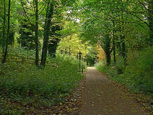
Harborne Walkway, site of Hagley Road Station. One of three intermediate stations on the line, and the only one with a goods siding. This photo shows the shady woodland path in early autumn.
The walkway is also lined with a variety of wildflowers, adding vibrant colors and supporting local pollinators. Bird enthusiasts can observe species such as water wagtails, wrens, and jays along the path. Additionally, a bird sanctuary adjacent to a section of the walkway provides a protected habitat for various avian species. The lush vegetation along the trail also shelters small mammals, contributing to the area's biodiversity.


