Hartest Walks
![]()
![]() This Suffolk village is located in the Babergh district of the county.
This Suffolk village is located in the Babergh district of the county.
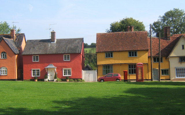
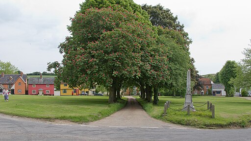
It's a charming place located just a few miles north of Glemsford and arranged around a large green, surrounded by delightful period cottages. Its name derives from Old English, meaning 'Hart's Wood', indicating an area frequented by deer.
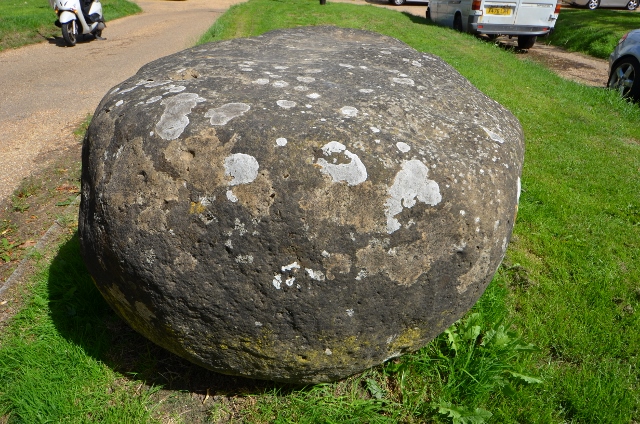
A prominent feature on the village green is the Hartest Stone, a sizable granite block found in Somerton in 1713. This stone was transported to Hartest to celebrate the Treaty of Utrecht, which concluded the War of the Spanish Succession. The end of the war on 7 July 1713 was marked by nationwide festivities, and in Hartest, the arrival of the stone to the green, hauled by 40 horses and a trumpeter, commemorated this occasion.
Local lore suggests that the stone turns over at midnight, and sitting on it at this time supposedly brings good luck or a spouse.
Hartest is home to over 50 listed buildings, a testament to its traditional character, with the oldest being a timber-framed Wealden house from 1470.
Near the green stands one such listed building, the All Saints parish church. This beautiful church, primarily 15th century with significant Victorian restorations, boasts a two-tier octagonal Jacobean pulpit inside. Not all of Hartest's historic structures are ancient; the Boxted and Hartest Institute, established in 1888 by Thomas Weller-Poley as a Reading room, was designed by architect Reginald T Blomfield, later President of the R.I.B.A. The Institute, in the Arts and Crafts style, now hosts various events such as meetings, dances, and weddings.
The village lies at the foot of Hartest Hill, reportedly Suffolk's steepest hill. On the village's outskirts is Hartest Wood, a 1.21-hectare broadleaf woodland planted in 1999, its layout mirroring the village map.
Please scroll down for the full list of walks near and around Hartest. The detailed maps below also show a range of footpaths, bridleways and cycle paths in the area.
Hartest Ordnance Survey Map  - view and print off detailed OS map
Hartest Open Street Map  - view and print off detailed map
Hartest OS Map  - Mobile GPS OS Map with Location tracking
Hartest Open Street Map  - Mobile GPS Map with Location tracking
Walks near Hartest
- Glemsford - This Suffolk based village is located in the Stour Valley near Cavendish
- Cavendish - Cavendish stands out as a particularly charming village in Suffolk, renowned for its delightful thatched cottages and scenic village green
- Clare Castle Country Park - This pretty country park is situated on the River Stour in the Suffolk town of Clare
- Stour Valley Path - Follow the River Stour from Newmarket to Cattawade on this delightful walk through East Anglia
- Bury St Edmunds - This walk visits some of the highlights of this lovely Suffolk town using sections of the St Edmund Way and Bury to Clare Walk
- Bury to Clare Walk - Follow the Bury to Clare Walk from Bury St Edmunds to Clare on this walk through Suffolk
- Sudbury - This circular walk takes you around the delightful Water Meadows in the Suffolk town of Sudbury
- Haverhill - This Suffolk based town has some nice local trails along the Stour Brook and the River Stour which run through the area.
- Bures - This pretty village is located in a lovely spot on the River Stour on the Suffolk/Essex county border
- Castle Hedingham - This walk explores the Essex based village of Castle Hedingham and its historic castle grounds.
- Gosfield Lake - This walk visits the village of Gosfield in the Braintree district of Essex near Halstead
- Melford Country Park - This walk visits Melford Country Park in the village of Long Melford in Suffolk.
- Melford Hall - Enjoy a walk around the beautiful grounds of Melford Hall in Suffolk
- Kentwell Hall Long Melford - This circular walk explores the beautiful grounds of this 16th century stately home in Long Melford, Suffolk
- Lavenham - This pretty Suffolk village has lots of good options for walkers wishing to explore the area
Pubs/Cafes
Tucked away behind a tall screen of trees near the church, you'll find The Crown Inn, a charming and historic pub. Originally, The Crown served as Hartest Hall, a residence for the Bishop of Ely's steward. In the 16th century, it functioned as a courthouse. It underwent a transformation into a pub in the 18th century, though it continued to host petty sessions until at least 1766. In 1778, Ann Butts, the wife of the Bishop, bequeathed the inn to her daughter. Since then, The Crown has remained under private ownership. You can find them at postcode IP29 4DH. The pub is dog friendly.


