Hawkhurst Walks
![]()
![]() This walk visits the Kentish village of Hawkhurst in the High Weald near Tunbridge Wells.
This walk visits the Kentish village of Hawkhurst in the High Weald near Tunbridge Wells.
The village is split into two distinct areas known as The Moor and Highgate. This walk starts from the car park in the Highgate section and follows footpaths south to visit the Moor. Here you pick up the Sussex Border Path and follow the waymarked path south through the countryside to visit one of the area highlights at Bodiam Castle. At the historic castle you'll find some lovely grounds surrounding the historic castle, with a moat, parkland and riverside trails along the River Rother.
Postcode
TN18 4NX - Please note: Postcode may be approximate for some rural locationsHawkhurst Ordnance Survey Map  - view and print off detailed OS map
Hawkhurst Open Street Map  - view and print off detailed map
Hawkhurst OS Map  - Mobile GPS OS Map with Location tracking
Hawkhurst Open Street Map  - Mobile GPS Map with Location tracking
Walks near Hawkhurst
- Tunbridge Wells Circular Walk - Explore the beautiful countryside around Royal Tunbridge Wells on this circular walk through the High Weald AONB
- Tunbridge Wells Common - Explore this large green space on this pleasant walk in Tunbridge Wells
- Sussex Border Path - A fabulous long distance walk following the Sussex county border from Thorney Island in West Sussex to Rye in East Sussex
- Bodiam Castle - This 14th century moated castle in Sussex is one of the National Trust's most visited properties
- Brede High Woods - This large area of ancient woodland consists of hundreds of acres of walking trails, a variety of wildlife and the pretty Powdermill Reservoir
- Powdermill Reservoir - This circular walk takes you through the woodland surrounding Powdermill Reservoir in Sussex
- Burwash - This picturesque East Sussex based village is surrounded by some lovely High Weald countryside.
- Bewl Water - This is a walking and cycling route around the beautiful Bewl Water reservoir near Lamberhurst
- Bedgebury Forest - Bedgebury is a great place for cyclists with miles of family cycle tracks and a more challenging mountain bike trail
- Sissinghurst Castle - Explore the 460 acres of gorgeous Wealden countryside in the Sissinghurst Castle Estate on this walk in Kent
Pubs/Cafes
The Eight Bells dates back to the 18th century and sits in a fine spot on the beautiful Moor in Hawkhurst. They do a fine Sunday roast which you can enjoy in the lovely beer garden. You can find them at postcode TN18 4NX for your sat navs.
Photos
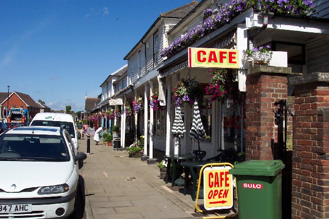
Shops in Hawkhurst, Kent. The Highgate area includes a two hundred year old Colonnade with some splendid historic buildings. The Hawkhurst Heritage Trail will take you to several of these.


