Helm Crag Circular Walk from Grasmere
![]()
![]() Enjoy a circular walk to the summit of this distinctive fell in the Lake District. Alfred Wainwright said of Helm Crag: 'The virtues of Helm Crag have not been lauded enough. It gives an exhilarating little climb, a brief essay in real mountaineering, and, in a region where all is beautiful, it makes a notable contribution to the natural charms and attractions of Grasmere'. The route runs for a distance of about 4 miles along a series of public footpaths.
Enjoy a circular walk to the summit of this distinctive fell in the Lake District. Alfred Wainwright said of Helm Crag: 'The virtues of Helm Crag have not been lauded enough. It gives an exhilarating little climb, a brief essay in real mountaineering, and, in a region where all is beautiful, it makes a notable contribution to the natural charms and attractions of Grasmere'. The route runs for a distance of about 4 miles along a series of public footpaths.
The ascent of Helm Crag is popular with walkers as it begins from the lovely town of Grasmere and is an easy/moderate climb.
The walk begins at the centre of Grasmere and follows the Easedale Road to Lancrigg, passing Easedale Beck on the way. You then follow footpaths to the summit of Helm Crag, passing White Crag on the way. The summit has wonderful views over Grasmere and towards the Helvellyn range. You will also see two rocky outcrops known as The Lamb & Lion and the striking 'Howitzer' which is the high point on Helm Crag. From the summit you soon reach Helmside where you descend back to Grasmere on country lanes.
Helm Crag Ordnance Survey Map  - view and print off detailed OS map
Helm Crag Open Street Map  - view and print off detailed map
*New* - Walks and Cycle Routes Near Me Map - Waymarked Routes and Mountain Bike Trails>>
Helm Crag OS Map  - Mobile GPS OS Map with Location tracking
Helm Crag Open Street Map  - Mobile GPS Map with Location tracking
Pubs/Cafes
Back in Grasmere head to Tweedies for some well earned refreshments. This nice pub has a very large beer garden with plenty of tables. It's a lovely place to sit out and relax in after a long walk. You can find it in the village, near the lake, at a postcode of LA22 9SW for your sat navs.
Further Information and Other Local Ideas
Head about a mile west of the crag and you'll come to Easedale Tarn. There's a lovely walk up to the tarn along Easedale Beck which you can pick up to the south of the crag. On the way you'll pass a series of picturesque waterfalls before coming to the tranquil tarn.
Cycle Routes and Walking Routes Nearby
Photos
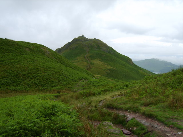
Helm Crag. Looking over Bracken Hause. Alfred Wainwright wrote of Helm Crag that "The virtues of Helm Crag have not been lauded enough. It gives an exhilarating little climb, a brief essay in real mountaineering, and, in a region where all is beautiful, it makes a notable contribution to the natural charms and attractions of Grasmere."
The top of the crag, the iconic hill which towers over Grasmere. Here you can see over Grasmere to Loughrigg.
Though modest in height at 405 metres, it is one of the most recognisable peaks in the area due to its distinctive summit formations. The rocky outcrops at the top include "The Lion and the Lamb" and "The Howitzer," which appear dramatically different depending on the viewpoint. The Howitzer, the highest point of the fell, requires a short scramble to reach, making it one of the few Wainwright summits that require hands-on climbing.
The jagged summit rocks of this popular fell. The views from Helm Crag are spectacular, offering a panoramic outlook over Grasmere and surrounding fells. To the north, the Helvellyn range dominates the skyline, while the southern views extend towards Windermere. The ascent from Grasmere is relatively short but steep, winding through woodlands and open slopes, making it a popular choice for walkers of varying abilities.
View of the northern summit of Helm Crag with Dunmail Raise behind and Helvellyn to the right. The fell is home to a range of flora and fauna, with heather and bracken carpeting the lower slopes and patches of bilberry adding to the mix. The area supports a variety of wildlife, including red squirrels in the nearby woodlands and birds such as kestrels and ravens that can often be seen soaring around the rocky summit. The rugged terrain provides an ideal habitat for small mammals, while the nearby fells support herds of hardy Herdwick sheep, a breed native to the Lake District.
Stepping stones over Easedale Beck. You'll pass along this pretty beck in the early stages of the walk. Helm Crag is also steeped in literary and cultural significance. The poet William Wordsworth, who lived nearby in Grasmere, often wrote about the surrounding landscape and would have been familiar with this distinctive summit. The fell’s dramatic rock formations have also captured the imagination of walkers and artists for generations, adding to its appeal as one of the most memorable peaks in the Lake District.
Elevation Profile


