Herne Bay to Reculver Walk
![]()
![]() This coastal walk takes you from Herne Bay to Reculver, passing through Reculver Country Park. It's just over 3 miles on a flat path with a short climb as you approach Reculver. On the way you will pass Beltinge Cliff and Bishopstones Nature Reserve where you can look out for wildlife including sand martins, skylarks, meadow pipits and corn buntings.
This coastal walk takes you from Herne Bay to Reculver, passing through Reculver Country Park. It's just over 3 miles on a flat path with a short climb as you approach Reculver. On the way you will pass Beltinge Cliff and Bishopstones Nature Reserve where you can look out for wildlife including sand martins, skylarks, meadow pipits and corn buntings.
The walk starts on the front in Herne Bay, near to the pier and the main parking area. Around here you can also see the Clock Tower built in 1837. It is believed to be one of the earliest purpose-built, free-standing clock towers in the United Kingdom.
Follow the coast path east to Beltinge where you will pass the first cliffs east of London. You continue past Bishopstone to Reculver Country Park where there are splendid sea views and a wide variety of wildlife and plantlife to see. Keep your eyes peeled for sanderlings, turnstones, fulmars and curlews in this area.
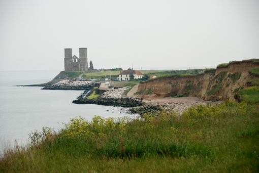
At the eastern end of the park you will find two interesting historical sites. Firstly there is St Mary's Church which includes the two medieval towers which are a major local landmark. There's also Regulbium where you will find the remains of an ancient Roman fort.
In the village you will find a cafe and pub where you can enjoy refreshments at the end of your walk.
The route uses a section of the Saxon Shore Way long distance trail so there is scope for extending your walk. You could head west on the popular Whitstable to Herne Bay Walk or east to visit Birchington and Margate.
Herne Bay to Reculver Ordnance Survey Map  - view and print off detailed OS map
Herne Bay to Reculver Open Street Map  - view and print off detailed map
Herne Bay to Reculver OS Map  - Mobile GPS OS Map with Location tracking
Herne Bay to Reculver Open Street Map  - Mobile GPS Map with Location tracking
Pubs/Cafes
At Herne Bay we recommend heading to the seaside Four Fathoms for some refreshments. The popular pub was voted Kent Life pub of the Year and includes a lovely courtyard garden where you can take in the wonderful fresh sea air in the sheltered surroundings. They do wonderful food and can be found on the High St, Herne Bay, with a postcode of CT6 5LH for your sat navs.


