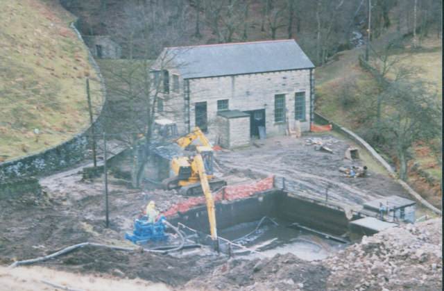
Holme Styes Reservoir
![]()
![]() This walk visits the pretty Holme Styes Reservoir near Holmfirth in Yorkshire. It's a lovely quiet spot and something of a hidden gem of the area.
This walk visits the pretty Holme Styes Reservoir near Holmfirth in Yorkshire. It's a lovely quiet spot and something of a hidden gem of the area.
You can find the small lake just over 2 miles south of Holmfirth. On the eastern side of the water there's some roadside parking where you can start the walk. From here you can pick up a circular trail running around the reservoir, part of which uses the Kirklees Way. You could head west along this waymarked footpath to explore the woodland to the west of the site.
Postcode
HD9 2DF - Please note: Postcode may be approximate for some rural locationsHolme Styes Reservoir Ordnance Survey Map  - view and print off detailed OS map
Holme Styes Reservoir Open Street Map  - view and print off detailed map
Holme Styes Reservoir OS Map  - Mobile GPS OS Map with Location tracking
Holme Styes Reservoir Open Street Map  - Mobile GPS Map with Location tracking
Further Information and Other Local Ideas
Just to the west there's some more waterside walks to be found around Brownhill Reservoir, Ramsden Reservoir and Digley Reservoir.
Cycle Routes and Walking Routes Nearby
Photos
Footpath across the River Ribble at Holme Styes. The lesser-known River Ribble, that is, the Yorkshire one (a minor tributary of the Holme) rather than the Lancashire one. The footpath from Greave Road descends the steep field on the east side of the river, crosses it by a footbridge and turns left to ascend more gently into the woods on the west bank. The body of water on the left is the settling pond of the redundant treatment works (now demolished)


