Holnicote Estate
![]()
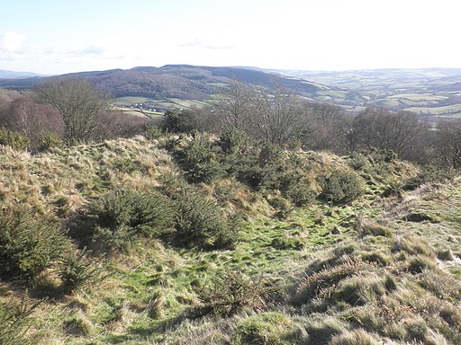
![]() This walk visits Selworthy Beacon and Bury castle in the splendid Holnicote Estate in Somerset. You start off in the village of Selworthy next to the church, and head to the nearby Bury Castle where you will find an Iron Age enclosure dating back to 400 B.C. You then climb to the 308 metres (1,010 ft) high Selworthy Beacon where there are marvellous views across Exmoor and the Somerset coast. It is one of the highest points in the Exmoor National Park along with Dunkery Beacon. From the high point you descend on Folly Combe, returning to the church soon after.
This walk visits Selworthy Beacon and Bury castle in the splendid Holnicote Estate in Somerset. You start off in the village of Selworthy next to the church, and head to the nearby Bury Castle where you will find an Iron Age enclosure dating back to 400 B.C. You then climb to the 308 metres (1,010 ft) high Selworthy Beacon where there are marvellous views across Exmoor and the Somerset coast. It is one of the highest points in the Exmoor National Park along with Dunkery Beacon. From the high point you descend on Folly Combe, returning to the church soon after.
If you would like to continue your walking in the area you could head to the nearby Dunkery Beacon. It is the highest point in Exmoor and consists of a beautiful nature reserve with woodland walks. You could also pick up the South West Coast Path and head west along this lovely stretch of coastline towards Bossington Hill and Porlock or east toward Minehead.
Holnicote Estate Ordnance Survey Map  - view and print off detailed OS map
Holnicote Estate Open Street Map  - view and print off detailed map
Holnicote Estate OS Map  - Mobile GPS OS Map with Location tracking
Holnicote Estate Open Street Map  - Mobile GPS Map with Location tracking
Pubs/Cafes
Back in Selworthy be sure to visit The Periwinkle Tea Rooms which is something of a local highlight. The delightful thatched tea rooms date from the 17th century and sit in a lovely position on Selworthy Green. It's beautifully laid out inside and there's also some splendid gardens to sit out in during the warmer months. It's the ideal spot to stop for a well earned cream tea after your walk. You can find them at postcode TA24 8TP for your sat navs.
Further Information and Other Local Ideas
The circular Selworthy Beacon Walk starts in the village and visits the beacon before heading to Hurlstone Point on the coast and the splendid 15th century pack horse bridge in the nearby village of Allerford.
To the south west near Dunkery Beacon you'll find the Nutscale Reservoir. The reservoir is actually part of the estate with the fishing rights owned by the National Trust. It's in a remote and scenic location with some nice trails to follow around the adjacent Wilmersham Common.
For more walking ideas in the area see the Exmoor Walks page.


