Walk around Hucknall
![]()
![]() This Nottinghamshire market town has some nice country trails, waterside paths around a nearby lake and a significant local park to explore.
This Nottinghamshire market town has some nice country trails, waterside paths around a nearby lake and a significant local park to explore.
The town includes a train station, attractive market square and a noteworthy church which is the burial place of the famous 18th and 19th century poet Lord Byron.
This circular walk around Hucknall visits some of the local walking highlights at Mill Lakes, Bestwood Country Park and Moorgreen Reservoir. It uses a mixture of public footpaths and a section of the long distance Robin Hood Way to complete the walk.
The walk starts at the train station and then heads south east through Broomhill to the Mill Lakes in Bestwood Park. You'll pass along the northern side of the pretty lakes before passing through Bestwood Village and entering the main section of the park where there's miles of peaceful woodland trails.
After exploring the park you then pick up the Robin Hood Way and follow it west through the golf course at Bulwell Hall Park. You continue to Watnall before turning north west to Greasley and Colliers Wood Nature Reserve on the outskirts of Eastwood. There's a pretty pond and lots of wildlife to see in this small, but worthy reserve.
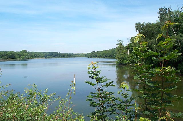
The route then passes north along Moorgreen Reservoir with more woodland and some lovely views across the still water.
The final section takes you east through High Park Wood to Misk Hill before returning to Hucknall.
Postcode
NG15 7BS - Please note: Postcode may be approximate for some rural locationsHucknall Ordnance Survey Map  - view and print off detailed OS map
Hucknall Open Street Map  - view and print off detailed map
Hucknall OS Map  - Mobile GPS OS Map with Location tracking
Hucknall Open Street Map  - Mobile GPS Map with Location tracking
Walks near Hucknall
- Bestwood Country Park - Bestwood Country Park is located on the outskirts of the city of Nottingham and consists of 650 acres of open green space
- Moorgreen Reservoir - This short walk visits Colliers Wood Nature Reserve before following footpaths to the nearby Moorgreen Reservoir.
The walk starts in the Colliers Wood car park just to the south of the reservoir - Felley Priory - This walk visits the historic Felley Priory near Underwood in Nottinghamshire.
- Shipley Country Park - This large country park near Ilkeston boasts 700 acres of attractive and varied landscape
- Papplewick - This pretty Nottinghamshire village is close to a major historical site and the woodland of Sherwood Forest
- Newstead Abbey - Explore the extensive parkland surrounding this former Augustinian priory and home to Lord Byron
- Blidworth Woods - Explore the pine woodlands and open heath of Blidworth Woods, on this peaceful walk in Sherwood Forest.
- Burntstump Country Park - Explore open grassland, woodland and glade in this country park in Nottingham
- Nottingham Canal - Enjoy a walk or cycle along this pretty canal in Nottingham
- Nottingham Circular Walk - This long circular walk makes use of various waymarked footpaths to take you on a tour of the city's rivers, canals, nature reserves and parks.
The walk starts at the train station and heads a short distance south to the River Trent
Further Information and Other Local Ideas
The town is located a few miles north of the city of Nottingham. Here you can enjoy easy waterside walking along the Nottingham Canal or try the Nottingham Circular Walk.
Photos
Bestwood Country Park. A good view to the north-west from this path. In the Leen Valley below is Hucknall, with its by-pass on the left. Bestwood Business Park below on the right.
Pond at Colliers Wood. Looking north with High Park Wood in the distance. Planted with marginals, including flag iris and purple loosestrife, to encourage wildlife. The area has been mined for coal for at least 700 years. Within a couple of miles of here over 200 shafts have been sunk. Colliers Wood and the surrounding area was once Moorgreen Colliery, opened by Barber, Walker & Co in 1865. Coal production from the three shafts began in 1871. At its peak the colliery produced over a million tons of coal in 1963. From that point, production gradually decreased and the pit eventually closed in 1985 when the seams were exhausted. Following landscaping, the land was converted into an industrial estate and the country park.


