Hutton Roof Crags and Farleton Fell
![]()
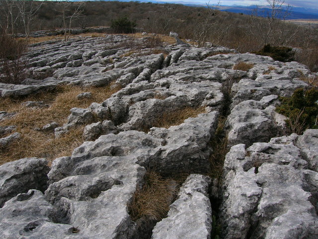
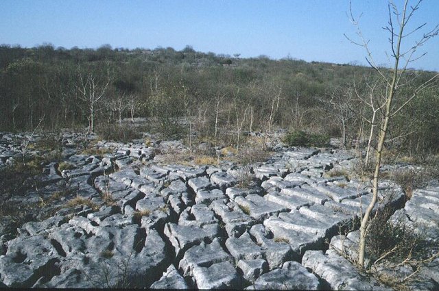
![]() Explore some of the finest limestone pavement in the country on this climb to Hutton Roof Crags and Farleton Fell. The scenery is striking with boulders and unusual rock formations covering the landscape. You'll pass across Hutton Roof Crags and climb over Newbiggin Crags before reaching the high point at Farleton Knot. All the way there are magnificent views over the surrounding fells. The area is also a nature reserve with a wide variety of interesting flora and fauna. Look out for fly orchids, lily of the valley and dark red helleborine. Wildlife includes small tortoiseshell and brimstone butterflies with birdlife such as woodpecker, long-tailed tits, redwing, fieldfare and mistle thrush. You may also see roe deer.
Explore some of the finest limestone pavement in the country on this climb to Hutton Roof Crags and Farleton Fell. The scenery is striking with boulders and unusual rock formations covering the landscape. You'll pass across Hutton Roof Crags and climb over Newbiggin Crags before reaching the high point at Farleton Knot. All the way there are magnificent views over the surrounding fells. The area is also a nature reserve with a wide variety of interesting flora and fauna. Look out for fly orchids, lily of the valley and dark red helleborine. Wildlife includes small tortoiseshell and brimstone butterflies with birdlife such as woodpecker, long-tailed tits, redwing, fieldfare and mistle thrush. You may also see roe deer.
This circular walk starts in the village of Hutton Roof and follows the Limestone Link over Hutton Roof Crags and Newbiggin Crags before reaching the high point at Farleton Knott. From here there are fabulous views over the Lake District and the Yorkshire Dales. The route then follows country lanes and other footpaths back to Hutton Roof.
Hutton Roof Crags is located a couple of miles west of Kirkby Lonsdale. You could start the walk from here and follow the Limestone Link to the crags.
To extend your walking in the area you could pick up the Lune Valley Ramble and enjoy a riverside stroll along the River Lune.
Also nearby is the beautiful Barbondale where there is a nice walk to Calf Top Hill and along the Barbon Beck.
Postcode
LA6 2PF - Please note: Postcode may be approximate for some rural locationsHutton Roof Crags and Farleton Fell Ordnance Survey Map  - view and print off detailed OS map
Hutton Roof Crags and Farleton Fell Open Street Map  - view and print off detailed map
Hutton Roof Crags and Farleton Fell OS Map  - Mobile GPS OS Map with Location tracking
Hutton Roof Crags and Farleton Fell Open Street Map  - Mobile GPS Map with Location tracking
Pubs/Cafes
We recommend heading into nearby Kirkby Lonsdale and visiting the Snooty Fox for some post walk refreshments. The classic old pub dates from the 17th century and has an excellent menu. There's also a nice beer garden to relax in on warmer days. You can find it in the attractive market town on Main Street with a postcode of LA6 2AH for your sat navs.
Dog Walking
The area is a great place for dog walking with woodland and country trails. There are quite a lot of sheep about so it's best to keep them under control in these area. The Snooty Fox mentioned above is also dog friendly.
Cycle Routes and Walking Routes Nearby
Photos
The Rakes, Hutton Roof Crags, near to Hutton Roof, Cumbria, Great Britain. Ingleborough in the distance. The crag is the front face of a tilted layer of limestone. On the 'back' of the layer are geologically famous limestone pavements with unusual solution features.


