Kinder Scout Walk
![]()
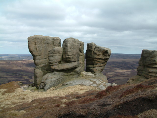
![]() Explore the Kinder plateau on this exhilarating and challenging circular walk from the popular village of Edale. You will enjoy spectacular views of the Hope Valley and pass some fascinating gritstone rock formations.
Explore the Kinder plateau on this exhilarating and challenging circular walk from the popular village of Edale. You will enjoy spectacular views of the Hope Valley and pass some fascinating gritstone rock formations.
The walk begins in the pretty village of Edale which can be reached by train from Manchester or Sheffield. You then pick up the Pennine Way and follow it to Upper Booth and on to the recently restored Jacob's Ladder footpath. The route then follows the spectacular Kinder plateau where you can enjoy some of the best views in the Peak District. At Grindsbrook Clough you descend to Edale along the delightful Grinds Brook with waterfalls and splendid views along the way.
For an easier walk in the area try the hike to Kinder Reservoir along the the Snake Path from Hayfield. It's a lovely spot with the reservoir surrounded by dramatic hills. You can continue from here and visit Kinder Downfall, the highest waterfall in the Peak District.
Mam Tor is located nearby so you could climb this dramatic hill to continue your climbing in the area. The Pennine Way also runs through the area so this could be easily picked up too.
Our Kinder Scout Easy Walk explores the beautiful Edale Valley below the plateau.
Kinder Scout Ordnance Survey Map  - view and print off detailed OS map
Kinder Scout Open Street Map  - view and print off detailed map
Kinder Scout OS Map  - Mobile GPS OS Map with Location tracking
Kinder Scout Open Street Map  - Mobile GPS Map with Location tracking
Further Information and Other Local Ideas
In nearby Hayfield you could pick up the popular Sett Valley Trail. The shared cycling and walking trail runs along a disused railway line to New Mills. On the way there's bluebell woods, another small reservoir and a delightful little cafe to stop off at.
For more walking ideas in the area see the Peak District Walks page.


