Kingsbridge and Bowcombe Creek
![]()
![]() Enjoy a circular walk to the lovely Bowcombe Creek from the popular market town of Kingsbridge in the South Devon AONB. There's much to enjoy in the area with lovely views of the boats in the estuary and nice green lanes with lots of wildflowers and butterflies to look out for.
Enjoy a circular walk to the lovely Bowcombe Creek from the popular market town of Kingsbridge in the South Devon AONB. There's much to enjoy in the area with lovely views of the boats in the estuary and nice green lanes with lots of wildflowers and butterflies to look out for.
The route starts in the town centre and passes through the town before heading east through the countryside to the Bowcombe Creek. The creek is a great place for bird watching with herons, egrets, redshank and shelduck to look out for. Buzzards and Peregrine Falcon are often seen overhead.
After exploring the creek the route then follows other footpaths back through the countryside to the town.
You can extend your walking in the area by heading south and enjoying a circular walk along the Salcombe and Kingsbridge Estuary.
Here you will find reed beds, mudflats and eelgrass beds supporting an abundance of wildlife on the estuary. Dolphins, seals and basking sharks can all be seen from the paths.
Kingsbridge and Bowcombe Creek Ordnance Survey Map  - view and print off detailed OS map
Kingsbridge and Bowcombe Creek Open Street Map  - view and print off detailed map
Kingsbridge and Bowcombe Creek OS Map  - Mobile GPS OS Map with Location tracking
Kingsbridge and Bowcombe Creek Open Street Map  - Mobile GPS Map with Location tracking
Pubs/Cafes
Head to the Crab Shell Inn for some refreshments after your walk. The pub is located in a great location on the quayside with fine views of the estuary. They do excellent seafood and also are well known locally for their excellent pizzas. You can find the pub at a postcode of TQ7 1JZ for your sat navs.
Dog Walking
The area is nice for dog walking and the Crab Shell Inn mentioned above is also dog friendly.
Further Information and Other Local Ideas
Head south and you can try the Salcombe and Bolt Head Circular Walk which visits some lovely cliff tops and woodland near the town.
A few miles to the north there's the worthy village of Loddiswell where you can enjoy some fine trails through the River Avon Valley. Near here there's also the climb to the viewpoint and Iron Age Hillfort at Blackdown Rings and the pretty riverside village of Aveton Gifford to explore.
For more walking ideas in the area see the Devon Walks page.
Cycle Routes and Walking Routes Nearby
Photos
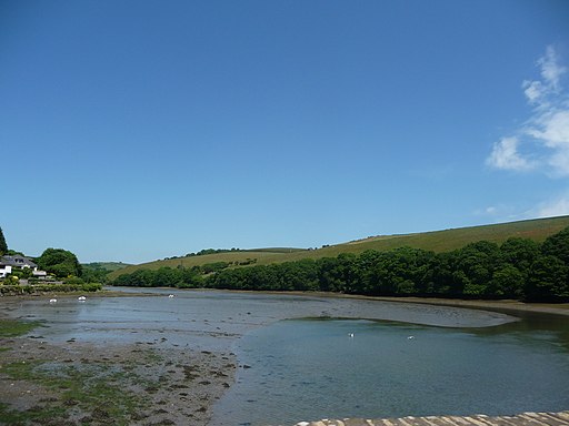
Looking almost due North up the estuary towards the town centre from the embankment by the Crabshell Inn, Tacket Wood on the opposite bank.
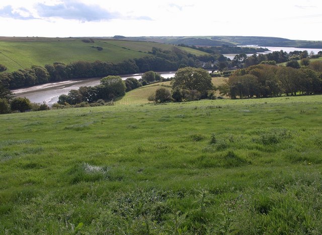
Bowcombe Creek. Looking towards and down the creek from Kingsbridge Footpath 6, across a side valley with High House Farm. The main Kingsbridge Estuary is on the right. Not the best time of day for this view, taken into the sun.


