GPS Cycle and Walking Routescycle iconwalk icon

Knott Hill Reservoir

0.8 miles (1.3 km)

Ordnance Survey Map Open Streetmap This walk takes you around the Knott Hill Nature Reserve in Tameside, Greater Manchester.
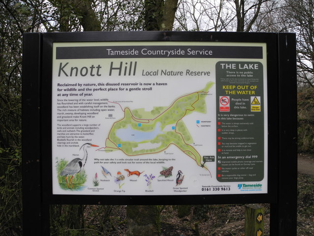
The reserve includes a pretty lake surrounded by peaceful woodland. There's nice footpaths with lots of flora and fauna to see including butterflies and great spotted woodpecker.
The reserve lies just to the south of Hartshead Pike. To extend the walk you could climb the hill for some fine views over the area.

Postcode

OL6 9AG - Please note: Postcode may be approximate for some rural locations

Knott Hill Reservoir OS Map Ordnance survey map - Mobile GPS OS Map with Location tracking

Knott Hill Reservoir Open Street Map Open Streetmap - Mobile GPS Map with Location tracking

Cycle Routes and Walking Routes Nearby

Photos

Western access to Knott Hill Lake - geograph.org.uk - 3406462

Western access to Knott Hill Lake

Loving Memory Benches - geograph.org.uk - 3402773

Loving Memory Benches

Knott Hill information board - geograph.org.uk - 3402395

Knott Hill information board

Knott Hill Local Nature Reserve - geograph.org.uk - 3402588

Woodland trails

Video

GPS Files

GPX File

Knott Hill Reservoir.gpx (On Desktop:Right Click>Save As. On Ipad/Iphone:Click and hold>Download Linked File)