Llyn Gwynant
![]()
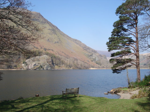
![]() Enjoy a circular walk around this beautiful lake in Snowdonia. The lake has nice paths along the water and through the surrounding woodland, with great views towards the mountains of Snowdonia. The lake links with Llyn Dinas where there are more nice trails to try.
Enjoy a circular walk around this beautiful lake in Snowdonia. The lake has nice paths along the water and through the surrounding woodland, with great views towards the mountains of Snowdonia. The lake links with Llyn Dinas where there are more nice trails to try.
The Snowdon Watkin Path also starts from the nearby Nant Gwynant car park so you could try this challenging climb to extend your walk. If you don't feel like climbing all the way to the summit then you could try the start of the path which is very pretty. It takes you through woodland to the Afon Cwm Llan where there are some lovely waterfalls.
If you head north along the Afon Glaslyn you could also visit Llyn Llydaw, one of the most visited lakes in the country.
Postcode
LL55 4NW - Please note: Postcode may be approximate for some rural locationsLlyn Gwynant Ordnance Survey Map  - view and print off detailed OS map
Llyn Gwynant Open Street Map  - view and print off detailed map
*New* - Walks and Cycle Routes Near Me Map - Waymarked Routes and Mountain Bike Trails>>
Llyn Gwynant OS Map  - Mobile GPS OS Map with Location tracking
Llyn Gwynant Open Street Map  - Mobile GPS Map with Location tracking
Pubs/Cafes
The Hebog Cafe & Bistro is a great place to head for refreshments after your walk. The food is excellent and there's also a lovely river terrace to sit out and enjoy the surrounding mountainous scenery in the summer months. You can find it in the centre of nearby Beddgelert on Caernarfon Road, with postcode LL55 4UY for your sat navs.
Closer to the lake is the excellent Caffi Gwynant. The cafe offers a wide range of foods prepared using local produce, daily specials, homemade cakes and desserts, local ales and free wi-fi. There's also an impressive outdoor glass canopy which is dog friendly. You can find the cafe at postcode LL55 4NH.
Further Information and Other Local Ideas
Just to the west of Llyn Dinas you can visit the site of the legend of the Red Dragon at the fascinating Dinas Emrys. There's a lovely trail with river views, waterfalls, attractive woodland and a small hill climb to the ancient ramparts of the ancient fort where there are fine views back down to the lakes below.
The waymarked Hafod Y Llan Walk can be picked up just west of the lake. The trail will take you through the National Trust's historically important hill farm with lots of wildlife and wonderful views from the high points.


