Maiden Castle Dorset
![]()
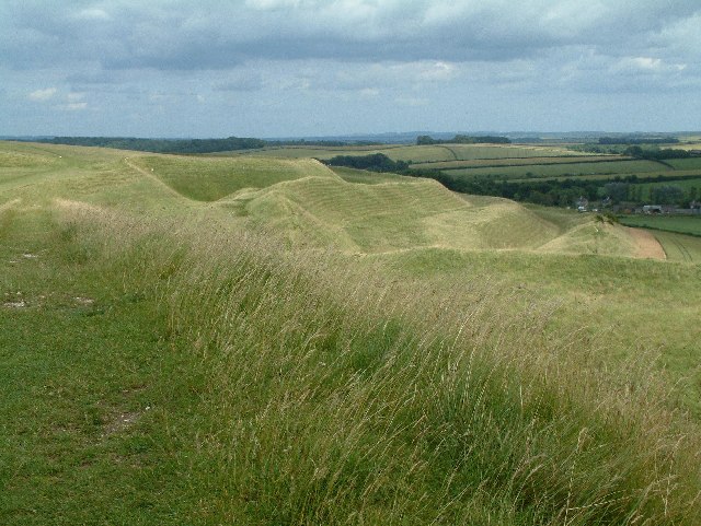
![]() Climb to this Iron Age hill fort near Dorchester and enjoy wonderful views over the surrounding countryside. Maiden Castle is the largest and most famous pre-Roman fortress in Britain. It covers almost 100 acres with banks as high as 80 feet enclosing a hill-top site of about 45 acres. It was inhabited as early as the Bronze Age, but most of the visible ramparts were erected in the 1st century BC.
Climb to this Iron Age hill fort near Dorchester and enjoy wonderful views over the surrounding countryside. Maiden Castle is the largest and most famous pre-Roman fortress in Britain. It covers almost 100 acres with banks as high as 80 feet enclosing a hill-top site of about 45 acres. It was inhabited as early as the Bronze Age, but most of the visible ramparts were erected in the 1st century BC.
There is a car park on Maiden Castle Road just north of the hill fort. From here you can pick up good footpaths to take you around the site. There's superb views to Dorchester and over the Dorset countryside as you make your way round the fort.
You can reach the site by bike by following National Cycle Network Route 2 from Dorchester. You can pick up the route from the centre of town near the train station. It's then about a one mile ride along Maiden Castle Road to the site.
The South West Coast Path runs just to the south of the hill so you could pick it up and head west to the Hardy Monument to extend your walk.
Postcode
DT2 9EY - Please note: Postcode may be approximate for some rural locationsPlease click here for more information
Maiden Castle Dorset Ordnance Survey Map  - view and print off detailed OS map
Maiden Castle Dorset Open Street Map  - view and print off detailed map
Maiden Castle Dorset OS Map  - Mobile GPS OS Map with Location tracking
Maiden Castle Dorset Open Street Map  - Mobile GPS Map with Location tracking
Explore the Area with Google Street View 
Pubs/Cafes
You could head west from the hill into the little village of Martinstown to visit The Brewers Arms for some refreshments after your walk. The pub is dog friendly and also has a nice garden to sit out in during the warmer months. You can find it in the village with a postcode of DT2 9LB for your sat navs.
Dog Walking
The walk is a fine one for fit dogs, though you are asked to keep them on leads because of the animals grazing in the surrounding fields. The Brewers Arms pub mentioned above is also dog friendly.
Further Information and Other Local Ideas
On the north eastern side of Dorchester you could visit Thorncombe Woods and Hardy's Cottage. The historic cottage is one of the highlights of the area and well worth seeing. The acclaimed author was born here in 1840 and wrote novels including 'Under the Greenwood Tree' and 'Far from the Madding Crowd' here. You can explore the quaint little cottage and learn about his life here. Outside there's an idyllic country garden to explore as well. To stretch your legs further head into the expansive Puddletown Forest which borders the cottage on the eastern side.
For more walking ideas in the area see the Dorset Walks page.
Cycle Routes and Walking Routes Nearby
Photos
Maiden Castle is a large Iron Age hillfort constructed in the 1st century BC and inhabited from 800 BC to AD43. The site also contains an older Neolithic enclosure dating from 3500 BC. The hillfort was abandoned some time after the Roman Conquest, but a Roman temple was constructed within the fort in the 4th century AD.
Ramparts, Maiden Castle. The castle is one of the largest earthwork fortifications in Europe. It is more than two miles round the perimeter, and its terraced ramparts rise to more than 80ft. Tools and pottery found beneath the ramparts indicate that the site was first occupied circa 2000BC, then fortified in the Iron Age from 300 BC onwards, the existing ramparts were constructed. The hill fort was captured by the Romans under Vespasian in AD43.
Footpath on the hill. The pattern of the footpath is like a thread across the great gouges of the ramparts. It was here in one of these,I believe, that Terence Stamp (as Sergeant Troy) played his sword charges at Julie Christie as (Bathsheba) in "Far From the Madding Crowd"
This is one of the many barrows that surround the iron age fort of Maiden Castle whose layered ramparts can be seen in the background. Most of these barrows (such as this one) lie on elevated ground or ridges with good views of the surrounding countryside.


