Marchlyn Mawr Walk
![]()
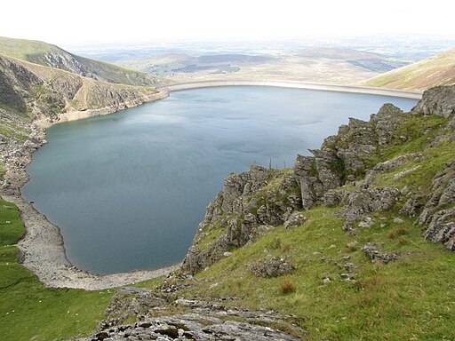
![]() This walk visits the Marchlyn Mawr Reservoir in the Snowdonia National Park.
This walk visits the Marchlyn Mawr Reservoir in the Snowdonia National Park.
The beauitful lake sits in a remote location next to the Elidir Fawr mountain. The area is also quite popular with cyclists as you can follow a road up to the lake on your bike.
You can start off from the roadside parking area in Buarth, a couple of miles north west of the reservoir. From near here you can pick up the surfaced track heading south east towards the slate quarry, the smaller Marchlyn Bach Reservoir and then onto the Marchlyn Mawr Reservoir. It's a fairly easy track that rises steadily towards the scenic lakes which sit in a stunning, remote spot. There's some wonderful views to the surrounding peaks in this isolated location.
You can extend the walk by climbing to the Elidir Fawr, the northernmost peak in the Glyderau range.
Marchlyn Mawr Ordnance Survey Map  - view and print off detailed OS map
Marchlyn Mawr Open Street Map  - view and print off detailed map
Marchlyn Mawr OS Map  - Mobile GPS OS Map with Location tracking
Marchlyn Mawr Open Street Map  - Mobile GPS Map with Location tracking
Further Information and Other Local Ideas
Just to the south there's Padarn Country Park where you can enjoy some wonderful walking and cycling around the stunning Llyn Padarn. You can also visit the unusual landscape of the Dinorwic Quarry in this area.
Cycle Routes and Walking Routes Nearby
Photos
The lake is used as the high level water source for Dinorwig power station, a closed-loop pumped storage hydroelectric generating facility.


