Mole Gap Trail - Leatherhead to Dorking Walk
![]()
![]() Follow the Mole Gap Trail from Leatherhead to Dorking on this pleasant short walk through the Surrey countryside. It's a lovely area with great views of the Surrey Hills AONB, woodland sections, pretty weirs and lots of wildlife to look out for. Keep your eyes peeled for water loving wildlife such as swans, kingfishers, herons, various duck species, and little egrets. The trail runs for a distance of about 6.5 miles (10km) and includes some small climbs on the way.
Follow the Mole Gap Trail from Leatherhead to Dorking on this pleasant short walk through the Surrey countryside. It's a lovely area with great views of the Surrey Hills AONB, woodland sections, pretty weirs and lots of wildlife to look out for. Keep your eyes peeled for water loving wildlife such as swans, kingfishers, herons, various duck species, and little egrets. The trail runs for a distance of about 6.5 miles (10km) and includes some small climbs on the way.
The walk begins by Leatherhead railway station and heads south along the River Mole towards Dorking.
On the way you will pass the 18th century manor house and gardens at Norbury Park, Denbies Hillside and Denbies Wine Estate - the largest vineyard in the UK. The trail then finishes in Dorking town centre.
Mole Gap Trail Ordnance Survey Map  - view and print off detailed OS map
Mole Gap Trail Open Street Map  - view and print off detailed map
*New* - Walks and Cycle Routes Near Me Map - Waymarked Routes and Mountain Bike Trails>>
Mole Gap Trail OS Map  - Mobile GPS OS Map with Location tracking
Mole Gap Trail Open Street Map  - Mobile GPS Map with Location tracking
Pubs/Cafes
Near Norbury Park and Box Hill you'll pass the excellent The King William IV pub. The main draw here is a wonderful garden terrace where you can enjoy your meal with panoramic views of the Mole Valley. On colder days you can sit inside next to the crackling log fire. You can find the pub at Byttom Hill, Mickleham with a postcode of RH5 6EL for your sat navs.
In Leatherhead there's the notewoerthy Running Horse. It dates back to 1403 and is ideally located next to the River Mole. There's a charming interior and a nice pub garden if the weather is fine. The pub was originally known as Rummings House, after Eleynor Rumminge who was written about by Henry VIII's poet John Skelton. The poem can be found on a wall in the pub. Legend also has it that Elizabeth I spent a night at the inn due to floods making the river Mole impossible to cross. You can find the pub on Bridge Street with a postcode of KT22 8BZ for your sat navs.
Dog Walking
The woodland and riverside paths make for an excellent dog walk and you're sure to see other owners on a fine day. The King William IV pub mentioned above is also dog friendly.
Further Information and Other Local Ideas
The trail passes the National Trust's Box Hill Country Park where there is a visitor centre and car park (postcode KT20 7LB). You can pick up the trail here so it makes a popular start point to the walk. The area is a great place to extend your walk with miles of trails and fine views over the Surrey Hills and North Downs.
The route passes through the small village of Westhumble where you'll find Box Hill and Westhumble train station. The station is a good access point for the walk if you were coming by public transport. It's reachable from London Victoria via Sutton, London Waterloo via Wimbledon and Dorking. Westhumble also includes the noteworthy ruins of a 12th century chapel and the Stepping Stones public house.
For more walking ideas in the area see the Surrey Hills Walks page.
Cycle Routes and Walking Routes Nearby
Photos
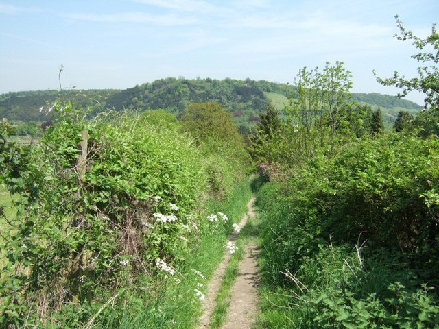
Looking towards Box Hill from the Mole Gap Trail, which first crosses Denbies Vineyard then follows the boundary East.
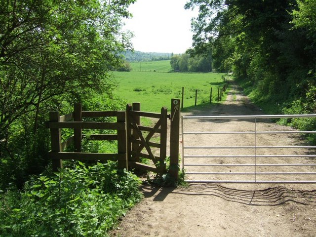
Coming down from Thorncorft Manor, the trail follows the River Mole here before climbing up into Norbury Park for the first time.
View up the trail to Norbury Park. The large white house is in the centre of Norbury Park. The estate of Norbury Park belongs to Surrey County Council today, but the house remains in private ownweship.
Elevation Profile


