Monk Coniston
![]()
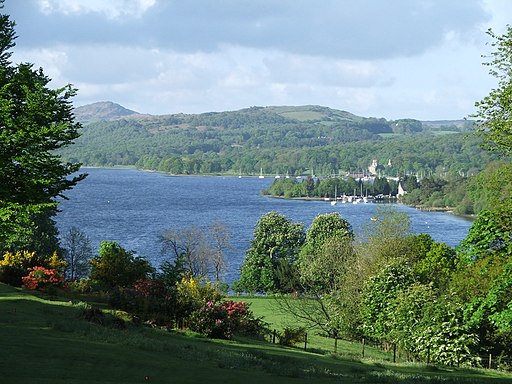
![]() This circular walk takes you through the pretty grounds of Monk Coniston hall to Tarn Hows in the Lake District. The walk starts from the Monk Coniston National Trust car park at the northern end of Coniston Water. It takes you through the Monk Coniston Hall estate with its walled garden, stone Gazebo and attractive woodland. Look out for a variety of flora and fauna including large redwoods and pretty woodland wildflowers. Wildlife includes roe deer, hares, common lizards and adders.
This circular walk takes you through the pretty grounds of Monk Coniston hall to Tarn Hows in the Lake District. The walk starts from the Monk Coniston National Trust car park at the northern end of Coniston Water. It takes you through the Monk Coniston Hall estate with its walled garden, stone Gazebo and attractive woodland. Look out for a variety of flora and fauna including large redwoods and pretty woodland wildflowers. Wildlife includes roe deer, hares, common lizards and adders.
At the northern end of the route you will come to the beautiful Tarn Hows where you can enjoy a waterside walk around the tarn with great views of the surrounding Lakeland mountains. From the northern tarn you can enjoy a climb to Black Crag for wonderful views of the area.
To extend your walking in the area you could enjoy a walk or cycle along Coniston Water.
The Cumbria Coastal Way also runs past the estate so you could pick up this long distance trail to further explore the area.
Postcode
LA21 8AH - Please note: Postcode may be approximate for some rural locationsMonk Coniston Ordnance Survey Map  - view and print off detailed OS map
Monk Coniston Open Street Map  - view and print off detailed map
Monk Coniston OS Map  - Mobile GPS OS Map with Location tracking
Monk Coniston Open Street Map  - Mobile GPS Map with Location tracking
Further Information and Other Local Ideas
For more walking ideas in the area see the Lake District Walks page.


