Mow Cop Walk
![]()
![]() Visit Mow Cop Castle and the Old Man of Mow on this short circular walk on the Cheshire–Staffordshire border. The castle sits in an elevated position above the village with wonderful views over the surrounding Staffordshire countryside and the Cheshire Plain. The 18th century folly is a well know landmark positioned 355m above sea level and visible for miles around. The walk also visits the Old Man of Mow - an interesting 65ft rock formation just to the north of the castle. Near here is a triangulation pillar and more great views to enjoy.
Visit Mow Cop Castle and the Old Man of Mow on this short circular walk on the Cheshire–Staffordshire border. The castle sits in an elevated position above the village with wonderful views over the surrounding Staffordshire countryside and the Cheshire Plain. The 18th century folly is a well know landmark positioned 355m above sea level and visible for miles around. The walk also visits the Old Man of Mow - an interesting 65ft rock formation just to the north of the castle. Near here is a triangulation pillar and more great views to enjoy.
Mow Cop is on the Gritstone Trail so you can extend your walk by continuing along this long distance trail.
Postcode
ST7 4LZ - Please note: Postcode may be approximate for some rural locationsMow Cop Ordnance Survey Map  - view and print off detailed OS map
Mow Cop Open Street Map  - view and print off detailed map
*New* - Walks and Cycle Routes Near Me Map - Waymarked Routes and Mountain Bike Trails>>
Mow Cop OS Map  - Mobile GPS OS Map with Location tracking
Mow Cop Open Street Map  - Mobile GPS Map with Location tracking
Explore the Area with Google Street View 
Pubs/Cafes
After your walk head to the Mow Cop Inn for some well earned refreshments. The pub has a good menu and an outdoor seating area. You can find it on Congleton Street at postcode ST7 3PJ.
The Crown Inn is another popular choice and also has a beer garden. You can find it in the village on Chapel St at postcode ST7 4NT.
Further Information and Other Local Ideas
Head west of the hill and you will soon come to the Trent and Mersey Canal. You can extend your walking here by heading west to visit Rode Hall. The Georgian country house is surrounded by lovely parkland with woodland, gardens and a large lake. Near here you can also visit the interesting market town of Sandbach with its historic 9th century crosses.
Just to the north west is Little Moreton Hall. The moated 16th-century half-timbered manor house has a fascinating history and lovely gardens to explore.
For more walking ideas in the area see the Staffordshire Walks and Cheshire Walks pages.
Cycle Routes and Walking Routes Nearby
Photos
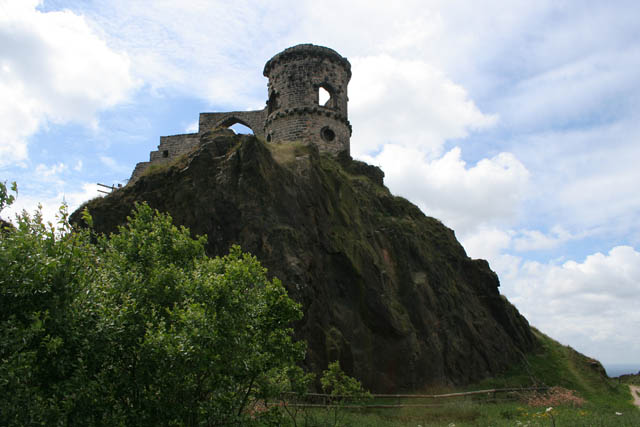
Mow Cop Castle From the north east. This "castle" commands an ideal defensible spot with far ranging views all around. The folly was built in 1754 by Randle Wilbraham of nearby Rode Hall as a summerhouse. It was last restored in 2003.
Mow Cop Quarry and Village. Looking over the stone quarry towards the village, taken from near the 18th Century Folly.
Slopes of Mow Cop. Looking down the rocky heathery slopes from part way up to the Castle. The large square building to the right, which straddles the gridline with SX8556, is a Wesleyan chapel built in 1852, now a museum.
Parson's Well in the village. Dated 1858, a similar time to the nearby Primitive Methodist Memorial Chapel and was apparently funded by Miss Wilbraham. An ode to this fact was written by Mr David Oakes "Mrs Wilbraham is a Lady born All other women she doth excel Twenty guineas she did lay down For making Parsons Well."
Primitive Methodist Memorial Church. The church was built in 1857 to replace the small original chapel. The village is much associated with the Primitive Methodist movement. In 1807 a camp meeting led by Hugh Bourne and William Clowes began the religious revival from which Primitive Methodism arose.


