Mynydd Troed Walk
![]()
![]() This circular walk climbs to Mynydd Troed and Cockit Hill in the Black Mountains section of the Brecon Beacons National Park. You'll also pass through the attractive valley of the River Rhiangoll on the return leg.
This circular walk climbs to Mynydd Troed and Cockit Hill in the Black Mountains section of the Brecon Beacons National Park. You'll also pass through the attractive valley of the River Rhiangoll on the return leg.
The walk starts at Pengenffordd which lies less than a mile to the north east of the mountain. From here you can pick up trails heading west and then south west to the 609 m (1,998 ft) summit.
You continue south to Cockit Hill, Mynydd Llangorse and Pentre where you cross a bridge over the river Rhiangoll. The route then follows a bridle track north along the river to return to Pengenffordd.
The walk can be extended by heading west to visit the lovely waterside paths at Llangorse Lake.
Mynydd Troed Ordnance Survey Map  - view and print off detailed OS map
Mynydd Troed Open Street Map  - view and print off detailed map
Mynydd Troed OS Map  - Mobile GPS OS Map with Location tracking
Mynydd Troed Open Street Map  - Mobile GPS Map with Location tracking
Further Information and Other Local Ideas
In nearby Talgarth there's ancient woodland and waterfalls to see in the Pwll-y-Wrach Nature Reserve. There's also some interesting local history with an 18th century watermill and the 11th century Bronllys Castle to visit.
Cycle Routes and Walking Routes Nearby
Photos
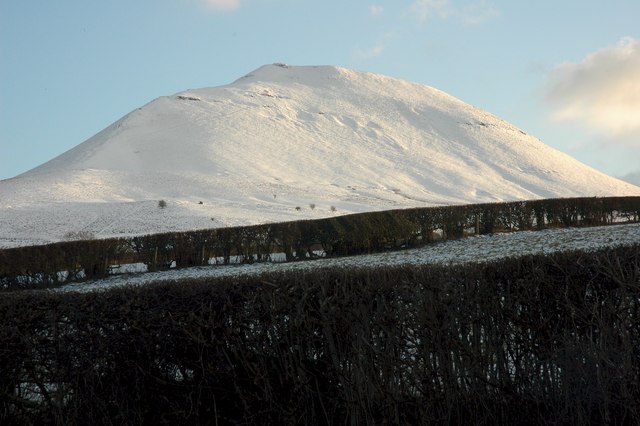
Mynydd Troed in snow. Its name literally translates to "Foot Mountain," based how it appears when viewed from the Allt Mawr ridge.


