Oakham Walks
![]()
![]() Oakham is the county town of Rutland and located in a lovely spot with miles of country trails and the wonderful Rutland Water nearby. The medieval market town also includes many sites of historical interest including the Norman Oakham Castle and the renowned Oakham School which dates back to 1584.
Oakham is the county town of Rutland and located in a lovely spot with miles of country trails and the wonderful Rutland Water nearby. The medieval market town also includes many sites of historical interest including the Norman Oakham Castle and the renowned Oakham School which dates back to 1584.
This walk takes you to Rutland Water from the town. You'll pass along the northern edge of the lake before visiting the dam.
The walk starts from the train station and heads east along the Hereward Way passing Oakham Castle before leaving the town at Dog Kennel Cottage. Here you turn south east to meet up with the lakeside path. Follow it east and it will take you along the lake, passing Burley Reach and the Lodge Inlet before coming to the Barnsdale Hill Hotel and Barnsdale Wood.
After passing through the little lakeside wood you come to the village of Whitwell where there's cycle hire and the departure point for the Rutland Belle Cruise. After passing Whitwell Creek you come to the eastern end of the lake where you'll find a Butterfly Centre and the dam.
This route returns to Oakham on the same paths but you could stroll into Empingham and catch the bus back if you prefer.
Oakham Ordnance Survey Map  - view and print off detailed OS map
Oakham Open Street Map  - view and print off detailed map
Oakham OS Map  - Mobile GPS OS Map with Location tracking
Oakham Open Street Map  - Mobile GPS Map with Location tracking
Pubs/Cafes
Back in the town head to The Wheatsheaf for some post walk refreshments. The 17th century inn has an interior full of character with oak beams and log fires. Outside there's an award winning beer garden to relax in for warmer days. You can find the pub at Northgate with a postcode of LE15 6QS for your sat navs. It's also dog friendly if you have your canine friend with you.
Further Information and Other Local Ideas
From the town you could head north and enjoy a stroll along the disused Oakham Canal. The canal ran from Oakham to Melton Mowbray and was closed in 1847. Most of it is now infilled but there are some short sections which still hold water and have footpaths running alongside.
The epic Macmillan Way also passes through Oakham. You could pick up the waymarked trail and follow it south west to Brooke and then turn east to visit the village of Manton and the pretty Manton Bay at the south western edge of Rutland Water.
At Whitwell you can pick up the Viking Way and follow it north to Exton and Greetham, passing Tunneley Woods on the way. From Exton there's a pleasant circular walk taking you around the parkland of the old Exton Hall before visiting the two pretty lakes at Fort Henry which lie just to the east. In the village you could also visit the noteworthy Barnsdale Gardens. The beautiful gardens were created by former Gardener's World presenter Geoff Hamilton during the 1980s and 1990s. They are now open to the public and include Britain's largest collection of individually designed gardens. Highlights are the ornamental kitchen garden, a cottage garden and the Versailles garden.
The Rutland Round also passes through the town. The long distance trail explores the county visiting Uppingham and Eyebrook Reservoir on the way.
For more walking ideas in the area see the Rutland Walks page.
Cycle Routes and Walking Routes Nearby
Photos
The Butter Cross, Oakham. The Butter Cross is a large polygonal timber structure round a stone pillar, with a pyramid roof. Behind it to the W, No. 37 has an early 18C front with dark blue brick chequer. The neo-Georgian Post Office of 1954 is in the background.
Great Hall, Oakham Castle, Oakham. The splendid Great Hall of Oakham Castle is one of the finest examples of late 12th century domestic architecture in England. It was built by Walkelin de Ferrers, a Norman baron, in about 1180-90. The remains of other parts of this fortified manor house lie beneath the grass of the inner bailey. It was surrounded by earthen banks and stone walls which had at least two towers. To the north were gardens and fishponds. The hall possesses a range of 12th century figure sculpture. Above the capitals of its fine columns there are six musicians, each playing a different instrument.
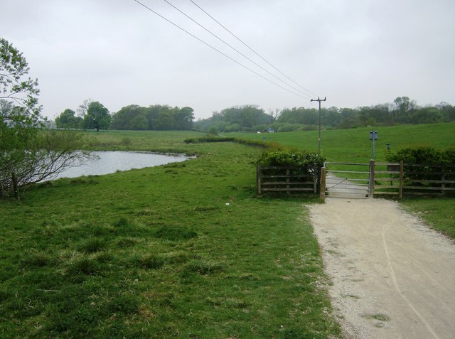
Cycle path round Rutland Water. The path leaves the confines of the water authority land and heads towards and parallel with the A606 on this north western section. Lodge Inlet is seen on the left. The path also forms part of the route of the Macmillan Way, a long-distance footpath from Lincolnshire to Dorset.


