GPS Cycle and Walking Routescycle iconwalk icon

Old Man of Hoy

5 miles (8 km)

Ordnance Survey Map Open Streetmap This walk takes you to the amazing 449-foot sea stack on the island of Hoy in the Orkney Islands.
The walk begins from the Rackwick car park and follows a popular signposted footpath to the Old Man of Hoy. There are splendid views of the beautiful Rackwick Bay and of the surrounding countryside and hills on this varied walk. Look out for peregrine falcons near the spectacular sea cliffs.

Old Man of Hoy OS Map Ordnance survey map - Mobile GPS OS Map with Location tracking

Old Man of Hoy Open Street Map Open Streetmap - Mobile GPS Map with Location tracking

Photos

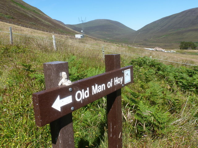
Rackwick, Old Man this way - geograph.org.uk - 2608156

Rackwick, Old Man this way

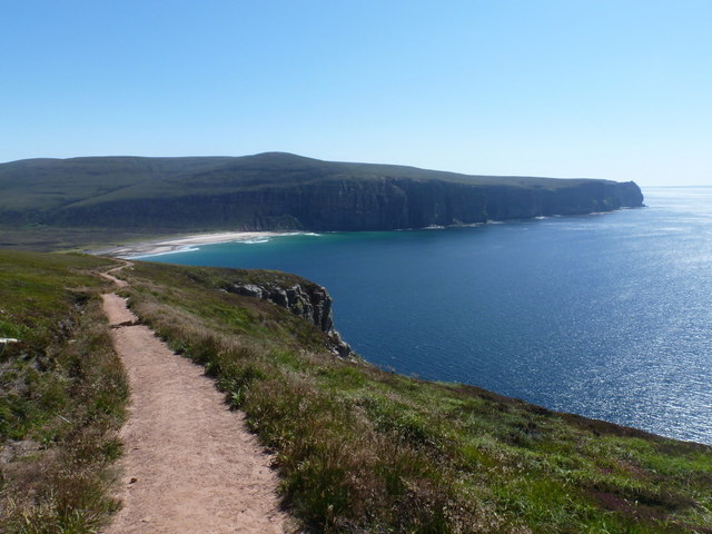
Footpath above Rackwick Bay - geograph.org.uk - 1532298

Footpath above Rackwick Bay. This path which leads to the Old Man of Hoy looks to have been maintained very recently. The coastal views are spectacular towards the one time fishing community of Rackwick.

Rackwick, the coast path passes Too of the Head - geograph.org.uk - 2534642

Rackwick, the coast path passes Too of the Head

Rackwick, towards Rora Head - geograph.org.uk - 2607019

Rackwick, towards Rora Head

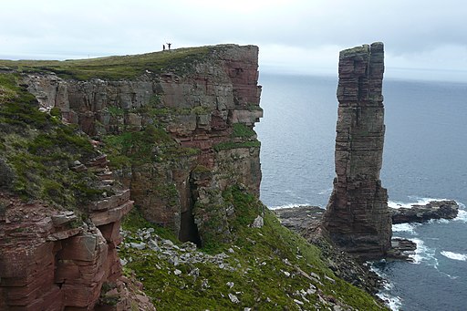
Old Man of Hoy (5927357279)

The Old Man of Hoy, a classic Sea Stack on the Orkney Island of Hoy. Reached via a newly repaired path from Rackwick. 449 feet (137 m) high

The Old Man of Hoy - geograph.org.uk - 2093917

The Old Man of Hoy

Video

GPS Files

GPX File

Old Man of Hoy.gpx (On Desktop:Right Click>Save As. On Ipad/Iphone:Click and hold>Download Linked File)

Memory Map Route

Old Man of Hoy.mmo (On Desktop:Right Click>Save As. On Ipad/Iphone:Click and hold >Download Linked File)