Parys Mountain
![]()
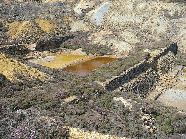
![]() This circular walk on the Isle of Anglesey visits the fascinating disused copper mines of Parys Mountain. The mountain was mined for copper ore in the early Bronze Age and dominated the world's copper market during the 1780s, when the mine was the largest in Europe. The mines are an extraordinary sight, rich with various ores and minerals. The striking mixture of colours and shadows from the undulating hills are very picturesque. From the elevated position there are wonderful views of the Anglesey coast and countryside. There is also an old windmill and a number of pools/ponds. Cyclists can reach the mountain by following the wonderful Copper Trail Cycle Route which is named after the mountain.
This circular walk on the Isle of Anglesey visits the fascinating disused copper mines of Parys Mountain. The mountain was mined for copper ore in the early Bronze Age and dominated the world's copper market during the 1780s, when the mine was the largest in Europe. The mines are an extraordinary sight, rich with various ores and minerals. The striking mixture of colours and shadows from the undulating hills are very picturesque. From the elevated position there are wonderful views of the Anglesey coast and countryside. There is also an old windmill and a number of pools/ponds. Cyclists can reach the mountain by following the wonderful Copper Trail Cycle Route which is named after the mountain.
The walk starts from the little village of Penysarn where there is a car park (You could also start from the car park at the northern end of the mountain on the B5111. This is shown on the street view link below).You then follow waymarked footpaths around the mountain with views towards Almwich Port to the north and the nearby Trysglwyn wind farm to the south. A unique walk it is well worth bringing your camera to capture this extraordinary landscape.
Postcode
LL68 9RE - Please note: Postcode may be approximate for some rural locationsParys Mountain Ordnance Survey Map  - view and print off detailed OS map
Parys Mountain Open Street Map  - view and print off detailed map
Parys Mountain OS Map  - Mobile GPS OS Map with Location tracking
Parys Mountain Open Street Map  - Mobile GPS Map with Location tracking
Explore the Area with Google Street View 
Pubs/Cafes
Head north into Amlwch and you could enjoy refreshments at The Queens Head. You can find them at 9 Queen St, Amlwch LL68 9AE. The coastal town is also well worth exploring with a visit to the Copper Kingdom visitor centre in Port Almwch recommended. Here you can learn all about the history of Amlwch's 18th century “Copper Rush” in a series of interesting exhibitions. You can find them at a postcode of LL68 9DB for your sat navs. To the west of Amlwch there's also the beautiful neighbouring village of Bull Bay, the most northerly village in Wales.
Dog Walking
The expansive area is great for dog walking and the Queens Head mentioned above is also dog friendly.
Further Information and Other Local Ideas
Head north and you could pick up the Anglesey Coast Path. If you follow it west you can visit some other highlights of the area at Cemaes Bay, the fascinating Porth Wen Brickworks and Cemlyn Bay.
The expansive Llyn Alaw lies just to the south west and is a good place for fishing and wildlife spotting. A couple of miles to the west of the lake there's also Llanddeusant where you can explore the fascinating Llynon Mill. The 18th century mill is notable as the only working windmill in Wales. The site also includes two Iron Age roundhouses where you can learn all about the ancient history of the area.
To the north the Amlwch Walk will take you along the coast to the historic lighthouse and viewpoint at Point Lynas.
For more walking ideas in the area see the Anglesey Walks page.
Cycle Routes and Walking Routes Nearby
Photos
View of modern mine on Parys Mountain. This view is from the Parys Mountain Copper Mines public car park. There is an Industrial Heritage Trail, comprising 7 features which can be seen within a 1-2 hour visit following the trail. Over 4000 years of mining history continues today from this modern mine.
The windmill. The Summit Windmill was built in 1878, in the hope of reducing pumping costs for the deepening mine shafts. The windmill was unique in Anglesey in having five sails.


