Pencaitland Railway Walk
![]()
![]() This shared cycling and walking trail runs along a disused railway line in Dalkeith near Edinburgh. The trail is also known as Sustrans National Cycle Route 196.
This shared cycling and walking trail runs along a disused railway line in Dalkeith near Edinburgh. The trail is also known as Sustrans National Cycle Route 196.
It runs for a distance of just under 7 miles on a flat path which is suitable for most abilities. On the way look out for a variety of flora and fauna especially in the summer months when you can see lots of wildflowers. There's also good information boards to look out for. These tell you about the history of the line which was built in 1867 and used until 1965 when it closed.
Start the walk from the public car park just to the south of Carberry Hill and Tower. From here you can pick up the waymarked trail and follow it east towards the villages of Ormiston and Wester Pencaitland. The trail then finishes shortly after near Saltoun Forest. This end of the trail also has a car park if you prefer to start from here.
Postcode
EH21 8PZ - Please note: Postcode may be approximate for some rural locationsPencaitland Railway Walk Ordnance Survey Map  - view and print off detailed OS map
Pencaitland Railway Walk Open Street Map  - view and print off detailed map
Pencaitland Railway Walk OS Map  - Mobile GPS OS Map with Location tracking
Pencaitland Railway Walk Open Street Map  - Mobile GPS Map with Location tracking
Pubs/Cafes
The Mercat Grill is located close by and a good choice for some refreshments after your exercise. They do very good food and also have a superb garden area with tables and chairs for alfresco dining. You can find the bar at 10 Whitecraig Rd, Whitecraig with a postcode of EH21 8PG for your sat navs.
Dog Walking
The trail makes for a fine dog walk, but it's best to keep them on a lead as there are a few bikes around. The Mercat Grill mentioned above is also dog friendly, even serving up dog beers and gourmet treats for your four-legged friend!
Further Information and Other Local Ideas
Just to the north east there's another similar trail to try. The Haddington to Longniddry Railway Walk runs between the two East Lothian towns for a distance of about 5 miles. Near here you'll also find the Gosford Estate where there's some nice trails to follow around the grounds of grand mansion.
Dalkeith Country Park is located to the west of the route. There's some nice waymarked walking trails here running through ancient oak woodland and along the River Esk. The Penicuik to Dalkeith Railway Walk can be picked up near the park. It takes you through some of Midlothian’s historic villages on an easy path.
Carberry Hill and Tower are located near the start of the route. There's a fine woodland walk with excellent views over Edinburgh and the Firth of Forth. It's also of historic interest as the place where Mary Queen of Scots surrendered to the Confederate Lords in 1567. At the other end of the trail you'll find Saltoun Forest where there are more nice woodland paths to try.
Also in Dalkeith is Vogrie Country Park where you'll find some attractive parkland and gardens surrounding the baronial-styled Vogrie House.
Cycle Routes and Walking Routes Nearby
Photos
Pencaitland Railway Walk. Detail from the board at the southern end of the walk, with information about the history of the railway, which dates from 1857 and was closed in 1965 as passengers and freight declined with the increase in road travel.
A smart, new and decorative board near the car park at the southern end, with information about the walk, its wildlife and history
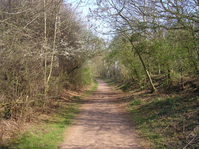
The view of the cycle path to Pencaitland to the south of the A6093. The cycle path is also a nature trail and follows the line of the former Gifford and Garvald Railway (from Ormiston to Gifford).
Rails on the Pencaitland Railway Path. The former Macmerry railway branch east of Crossgatehall and the former Gifford & Garvald Light Railway south from Ormiston to Saltoun have become official foot- and cycle-paths known as the Pencaitland Railway Walk. The only section of railway track left in situ is this bit embedded in a level crossing on a private road


