Walk around Plockton
![]()
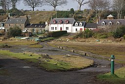
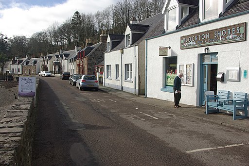
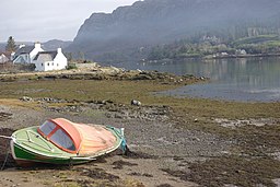
![]() This delightful Scottish village sits in a lovely spot on the shores of Loch Carron.
This delightful Scottish village sits in a lovely spot on the shores of Loch Carron.
It's considered one of the prettiest in the country and has been described as "The Jewel of the Highlands".
This walk takes you through the village and along the shores of the loch to nearby Duncraig. On the way you will visit the remote rail stations of Plockton and Duncraig on the Kyle of Lochalsh Line. It's just over two miles with glorious views over the loch to enjoy on the way.
On the opposite side of the loch you can pick up the Lochcarron Walk and visit the highly photogenic ruins of Strome Castle. From here you can enjoy an alternative view back to Plockton as well.
Postcode
IV52 8TW - Please note: Postcode may be approximate for some rural locationsPlease click here for more information
Plockton Ordnance Survey Map  - view and print off detailed OS map
Plockton Open Street Map  - view and print off detailed map
Plockton OS Map  - Mobile GPS OS Map with Location tracking
Plockton Open Street Map  - Mobile GPS Map with Location tracking
Pubs/Cafes
Head to the Plockton Inn for some refreshments after your walk. They serve delicious locally-landed fish and shellfish in their seafood restaurant.
You can find them on Innes Street at postcode IV52 8TW for your sat navs. The inn is dog friendly.
Further Information and Other Local Ideas
To the north there's Applecross where you can enjoy a lovely circular walk around a beautiful peninsula to Sand Bay.
To the south east there's Loch Duich and Glen Shiel where you'll find some pleasant waterside trails and views to the historic Eilean Donan Castle.
Cycle Routes and Walking Routes Nearby
Photos
The television series Hamish Macbeth, starring Robert Carlyle, was filmed here, substituting for the fictional Lochdubh.
Plockton Station. Plockton station was opened in 1897 when the railway was extended from its previous terminus at Stromeferry to Kyle of Lochalsh. The line was a candidate for closure in the 1960s and '70s but has survived as a lifeline for remote communities and carries a healthy tourist trade in summer. The station buildings are now used as self-catering holiday accommodation.
Duncraig Railway arch & fishing lodge. Adjacent to Duncraig station, on the South shore of Plockton harbour, the railway embankment is built out into the sea, at this point it encompasses a saltwater lagoon on the landward side, necessitating and arch and also features a ruined victorian fishing lodge.


