Poynton Canal Walk
![]()
![]() This circular walk from Poynton visits Poynton Park and the Macclesfield Canal. There's nice waterside sections along Poynton Lake and the canal. You'll also enjoy fine views of the Cheshire countryside, some woodland sections and a stretch along the Poynton Brook.
This circular walk from Poynton visits Poynton Park and the Macclesfield Canal. There's nice waterside sections along Poynton Lake and the canal. You'll also enjoy fine views of the Cheshire countryside, some woodland sections and a stretch along the Poynton Brook.
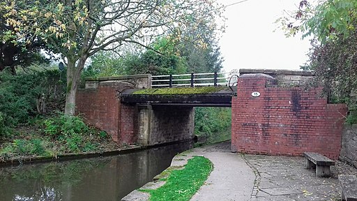
The walk starts in the pretty Poynton Park, just to the north of the town centre. You head east from the park and follow public footpaths through the countryside to the canal at Higher Poynton. Here you can pick up the towpath and follow it south to the Lyme View Marina and Adlington Basin. The marina is a very pretty spot on the canal and a nice place to stop and watch the boats go by.
At the basin you leave the canal and head west to Wardsend and Poynton Brook. You follow a footpath along the brook before turning north to head through the town back to the park.
To continue your walking in the area you could head east from the town and visit Lyme Park where there's miles of good trails to explore. Also of interest is the lovely Ladybrook Valley Interest Trail. This waymarked trail can be picked up on the northern side of the lake. It will take you west to Cheadle along the pretty Ladybrook.
Poynton Ordnance Survey Map  - view and print off detailed OS map
Poynton Open Street Map  - view and print off detailed map
Poynton OS Map  - Mobile GPS OS Map with Location tracking
Poynton Open Street Map  - Mobile GPS Map with Location tracking
Walks near Poynton
- Macclesfield Canal - Follow the towpath of the Macclesfield Canal from Marple to Kidsgrove on this waterside walk in Cheshire
- Ladybrook Valley Interest Trail - This walk follows various brooks from Cheadle to Disley via Hazel Grove.
You start off at Abney Hall Park in Cheadle - Lyme Park - This is a circular walk through the splendid Lyme Park in Disley, Cheshire
- Prestbury - This delightful Cheshire based village is a fine place for an easy stroll
- White Nancy - This walk climbs to unusual structure of White Nancy overlooking the town of Bollington in Cheshire
- Bollington - This circular walk explores the area surrounding the Cheshire town of Bollington
- Macclesfield - This market town in Cheshire has an abundance of local options for walkers
- Pott Shrigley - This little village in the Peak District is close to some splendid hill climbs and canalside trails
- Hazel Grove - Hazel Grove is located in the Stockport area of Greater Manchester, close to the Peak District National Park.
Pubs/Cafes
The Miner's Arms is located a couple of minutes walk from the Adlington Basin on the canal. The classic old country pub does good food and has a nice large beer garden to sit out and relax in on warmer days. There's a cosy fire indoors, a good sized car park and it's also dog friendly. You can find the pub on Wood Lane North at a postcode of SK10 4PF for your sat navs.
Further Information and Other Local Ideas
Just to the south west the worthy village of Prestbury is well worth a visit.
The village includes several listed timber framed buildings, a 17th century pub, a picturesque churchyard and views of the River Bollin. Look out for famous faces too as it is one of the most desirable places to live in the north with many celebrities and footballers purchasing expensive properties in the area.
For more walking ideas in the area see the Cheshire Walks page.
Photos
Adlington Basin. The former Adlington Colliery Basin on the Macclesfield Canal is now a thriving marina with nearby cafe and restaurant.


