Raad ny Foillan - Isle of Man Coastal Path
![]() Follow the Isle of Man Coast path along the beautiful Manx coast and enjoy some stunning coastal scenery. The 95 mile (153km) walk is waymarked with a White gull on blue sign. This is beacause in English the route is known as 'The Way of the Gull'. The island is wonderful for flora and fauna. Look out for grey seals and a variety of seabirds including kittiwakes, Manx shearwaters, puffins and guillemots.
Follow the Isle of Man Coast path along the beautiful Manx coast and enjoy some stunning coastal scenery. The 95 mile (153km) walk is waymarked with a White gull on blue sign. This is beacause in English the route is known as 'The Way of the Gull'. The island is wonderful for flora and fauna. Look out for grey seals and a variety of seabirds including kittiwakes, Manx shearwaters, puffins and guillemots.
The walk starts in Douglas, the capital and largest town on the island. The first section heads south west to Castletown passing Santon Head and the lovely Langness peninsula. You'll also pass Dreswick Point the southernmost point of the main island of the Isle of Man.
From Castletown you continue west to Port St Mary and Spanish Head where there are views to the Calf of Man.
The route turns north to Port Erin where you will find the Isle of Man Railway Museum. From Port Erin you head to Peel climbing Bradda Hill and Cronk ny Arrey Laa where there are great cliff top views. You will also pass the magical Glen Maye with its picturesque waterfall and lush woodland trails.
At Peel there are great views of St Patrick's Isle and the ruins of Peel Castle.
From Peel you head to Kirk Michael and Jurby before arriving at the Point of Ayr. Here you will find a 19th century lighthouse designed by Robert Stevenson, grandfather of the novelist Robert Louis Stevenson. It is situated at northernmost point of the Isle of Man. It's a particularly lovely section of the walk with sand dunes, gorse and heather to enjoy.
From Point of Ayr you turn south to Ramsey, the second largest town on the island. Here you will find a large harbour and an interesting derelict pier.
From Ramsey you head to the village of Maughold and to the nearby Maughold Head. It is the easternmost point of the island and the closest to England.
The next section takes you from Maughold to Laxey passing the delightful Dhoon Glen with interesting flora and picturesque waterfalls and streams. You can reach the glen from Dhoon Glen Halt station on the Manx Electric Railway.
At Laxey there's a pretty harbour, beach and promenade. Here you will also find the Snaefell Mountain Railway which you can catch to the summit of Snaefell, the highest mountain on the Isle of Man.
The final leg then takes you back to Douglas via Clay Head and Onchan Head. On the way you'll pass the noteworthy Groudle Glen. Another of the Manx National Glens this area includes the popular Groudle Glen Railway, a delightful miniature railway run by local enthusiasts.
Postcode
- Please note: Postcode may be approximate for some rural locationsRaad ny Foillan - Isle of Man Coastal Path Open Street Map  - view and print off detailed map
Raad ny Foillan - Isle of Man Coastal Path Open Street Map  - Mobile GPS Map with Location tracking
Cycle Routes and Walking Routes Nearby
Photos
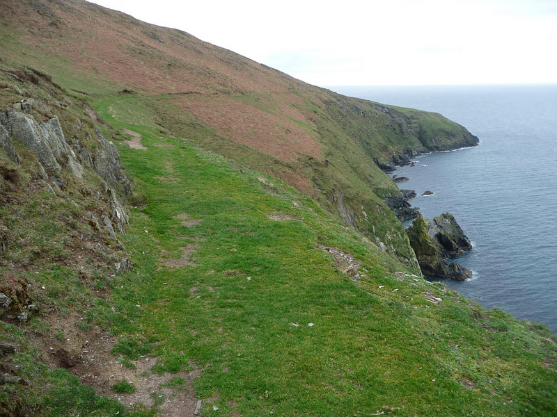
Looking north to Contrary Head and Corrins Hill from the Raad ny Foillan coastal path just north of Glen Maye.
Cottage at Ballachrink. One of several Ballchrinks, this one being on the Raad ny Foillan (coastal path) - note the signpost.


