Redisher Wood
![]()
![]() This walk visits the pretty Redisher Wood in Ramsbottom. The woods are a lovely place for a stroll, with sheltered trails along the Holcombe Brook to enjoy.
This walk visits the pretty Redisher Wood in Ramsbottom. The woods are a lovely place for a stroll, with sheltered trails along the Holcombe Brook to enjoy.
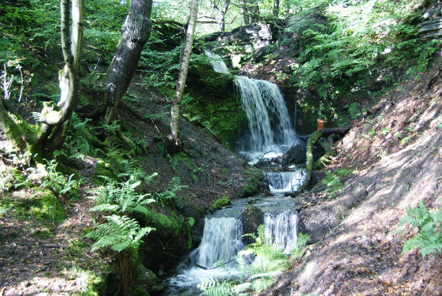
The trails will lead you north west to Simon's Lodge, a picturesque lake which looks particularly lovely surrounded by autumnal trees. Along the way you'll also pass a waterfall that flows impressively after heavy rain. The woods are also a nature reserve so keep your eyes peeled for a variety of woodland birds.
To continue your walking in the area pick up the circular Ramsbottom Walk and enjoy river paths along the Irwell Sculpture Trail before a climb to the splendid viepwoint at Peel Tower.
Postcode
BL0 9RY - Please note: Postcode may be approximate for some rural locationsRedisher Wood Ordnance Survey Map  - view and print off detailed OS map
Redisher Wood Open Street Map  - view and print off detailed map
Redisher Wood OS Map  - Mobile GPS OS Map with Location tracking
Redisher Wood Open Street Map  - Mobile GPS Map with Location tracking
Cycle Routes and Walking Routes Nearby
Photos
Redisher Wood Local Nature Reserve. This wooded valley at the base of Holcombe Hill is an ancient woodland site. In late Spring the steep valley sides are carpeted with Bluebells that line the banks of Holcombe Brook as it passes along the bottom of the valley. The woodland is home to a variety of birds including the Pied Flycatcher. The track to the right of the picture leads up to Redisher Lane.


