Regent's Park Walk
![]()
![]() This walk takes you around the beautiful Regent's Park in North London. There's 395 acres to explore with highlights including the stunning Queen Mary's Gardens which features 400 varieties of roses and a lovely waterfall. Stroll down long wide footpaths lined with pretty flowers and dotted with beautiful statues and fountains. There's also a large boating lake and the famous zoo to visit. You can extend the walk by crossing the Regent's Canal and climbing Primrose Hill for great views over the city. The waymarked 60km Jubilee Greenway also passes through the park so you could pick this up to explore the capital further.
This walk takes you around the beautiful Regent's Park in North London. There's 395 acres to explore with highlights including the stunning Queen Mary's Gardens which features 400 varieties of roses and a lovely waterfall. Stroll down long wide footpaths lined with pretty flowers and dotted with beautiful statues and fountains. There's also a large boating lake and the famous zoo to visit. You can extend the walk by crossing the Regent's Canal and climbing Primrose Hill for great views over the city. The waymarked 60km Jubilee Greenway also passes through the park so you could pick this up to explore the capital further.
Cyclists can pass through the northern end of the park along the canal. You can virtually explore the park using the google street view link below!
Postcode
NW1 4NR - Please note: Postcode may be approximate for some rural locationsRegent's Park Ordnance Survey Map  - view and print off detailed OS map
Regent's Park Open Street Map  - view and print off detailed map
Regent's Park OS Map  - Mobile GPS OS Map with Location tracking
Regent's Park Open Street Map  - Mobile GPS Map with Location tracking
Explore the Area with Google Street View 
Pubs/Cafes
The Boathouse Cafe is a family restaurant with a large terrace seating area where you can sit outside and enjoy views of the lake. It is located on The Boating Lake near Hanover Gate and sells sandwiches, toasties, flat bread pizza’s, soup, stew, cakes and snacks.
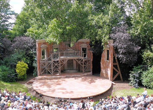
The Regent's Bar & Kitchen is located in the middle of Regent's Park on the Inner Circle, close to the Open Air Theatre and to the Queen Mary's Gardens. In good weather it includes a terrace BBQ offering burgers, hot dogs and vegetarian options alongside ice cold draft beer and Pimm's during the summer.
Cycle Routes and Walking Routes Nearby
Photos
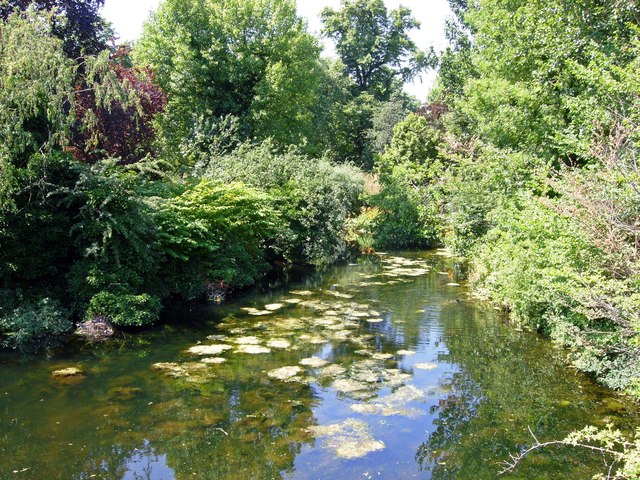
Regent's Canal, Regent's Park. Between Paddington and Camden Town, the Regent's Canal skirts the northern side of Regent's Park - an exceptionally attractive stretch of urban waterway.
It is hard to believe that this is central London, only yards from Marylebone Road and Baker Street station. It shows the lake from York Bridge.


