Rhandirmwyn Walks
![]()
![]() This pretty little village is located in a peaceful spot in the Upper Towy valley in Carmarthenshire. It's a lovely quiet place for a walk with scenic views and a fine old pub to relax in afterwards.
This pretty little village is located in a peaceful spot in the Upper Towy valley in Carmarthenshire. It's a lovely quiet place for a walk with scenic views and a fine old pub to relax in afterwards.
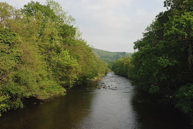
This circular walk from the village visits the River Towy (Afon Tyfi) before heading to the old Nantymwyn Lead mine. Here you'll find some photogenic old remains of this significant mine which are a scheduled ancient monument. You'll then explore the peaceful woodland area at Nant Gwyn to the east of the village. The final section links up with the river where there's some lovely views down the Towy Valley from the bridge on the western side of the settlement.
You can continue your walking by picking up the Cwm Rhaeadr Waterfall Walk.
Postcode
SA20 0NY - Please note: Postcode may be approximate for some rural locationsRhandirmwyn Ordnance Survey Map  - view and print off detailed OS map
Rhandirmwyn Open Street Map  - view and print off detailed map
*New* - Walks and Cycle Routes Near Me Map - Waymarked Routes and Mountain Bike Trails>>
Rhandirmwyn OS Map  - Mobile GPS OS Map with Location tracking
Rhandirmwyn Open Street Map  - Mobile GPS Map with Location tracking
Walks near Rhandirmwyn
- Llyn Brianne - Enjoy a walk or cycle along this beautiful reservoir in central Wales
- Llandovery - This market town in the Cambrian Mountains has some nice riverside walks along the River Towy and River Bran to try
- Usk Reservoir - Follow the circular cycling and walking trail around the beautiful Usk Reservoir on this route in the Brecon Beacons National Park
- Cynghordy Viaduct - This circular walk visit the impressive Cynghordy Viaduct in Carmarthenshire
- Llandeilo - This circular walk takes you through the countryside surrounding the Carmarthenshire town of Llandeilo
- Dinefwr Park - Explore the 12th-century Welsh castle, the historic house, the 18th-century landscaped park and the medieval deer park in this large park in Llandeilo.
- Llyn y Fan Fach - This is a super waterside walk through a particularly beautiful section of the Brecon Beacons
- Lampeter - This Ceredigion based town sits at the confluence of the Rivers Dulas Teifi
- LLanwrtyd Wells - This settlement in Powys is notable as the smallest town in Britain
- Gelli Aur Country Park - This lovely country park surrounds the Golden Grove mansion in Carmarthenshire.
- Garn Goch - This walk climbs to the hill fort at Garn Goch, located near Llandeilo and Llangadog in the Brecon Beacons.
- Tywi Valley - This walk explores the Tywi Valley and forest in the Cambrian Mountains.
Pubs/Cafes
Head to the splendid Royal Oak Inn for some post walk refreshment. There's a good menu and a nice outdoor seating area with views of the Upper Towy Valley. The cosy interior has a good atmosphere and real log fires. They also provide accommodation so if you need to stay over to further explore the area it's a great choice. You can find the pub in the village at postcode SA20 0NY for your sat navs.
Dog Walking
The river and woodland trails around the village are ideal for a dog walk. The Royal Oak mentioned above is also dog friendly.
Further Information and Other Local Ideas
Head north from the village and you could visit the beautiful Llyn Brianne. Near here there's also the glorious Tywi River Valley and the expansive Tywi Forest where you can look out for red squirrels.
Head south and there's the nearby town of Llandovery where you could visit the 13th century castle and the Usk Reservoir.
For more walking ideas in the area see the Cambrian Mountains Walks and the Brecon Beacons Walks page.
Photos
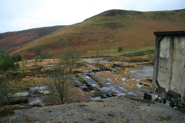
Old mill, Nantymwyn mine. These are the remains of the flotation mill built by the Sulphide Corporation around about 1929 as part of its heavy investment in new processing plant on the site associated with the sinking of New Shaft. The mill used chemical flotation processes to separate out lead and zinc. The mine was abandoned in 1932.
Angred Shaft, Nantymwyn mine. The typical cone-shaped run-in in front of the engine house is the site of Angred Shaft, which was just over 200 metres deep and intersected the mine's Deep Boat Level. The engine house and chimney for the beam pumping and winding engine that worked in the shaft are a scheduled monument, but the lack of care and maintenance means that the engine house in particular is now in a very poor state.
Ore bins, Nantymwyn lead mine. These are some of the remains of the ore processing plant installed below Pen Cerrig-mwyn by the Sulphide Corporation, which ran the mine from 1927. Ore from the crushing mill built beside New Shaft was fed through these bins and hoppers into the flotation plant to separate out lead and zinc.


