Rhigos Mountain Walks
![]()
![]() This walk explores the hills and lakes around the village of Rhigos in the Rhondda Cynon Taf.
This walk explores the hills and lakes around the village of Rhigos in the Rhondda Cynon Taf.
The walk starts from the excellent Rhigos Mountain Viewpoint car park. It's a beautiful spot with fine views over the Vale of Neath and the Cynon Valley. Head carefully west along the road and you will soon come to the
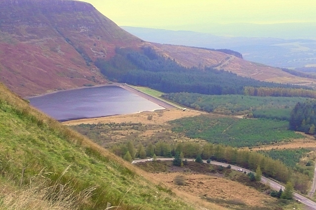
Coed Morgannwg Way. You can follow this waymarked footpath west above the twin lakes of Llyn Fawr and Llyn Fach. There are great views down to these two pretty lakes and some nice woodland trails through the surrounding forest. The trail will take you to another local hill at Craig Y Llyn which stands at 600 metres. The summit is the highest point in the traditional county of Glamorgan (Morgannwg), and the South Wales Valleys.
Postcode
CF44 9UF - Please note: Postcode may be approximate for some rural locationsRhigos Mountain Ordnance Survey Map  - view and print off detailed OS map
Rhigos Mountain Open Street Map  - view and print off detailed map
Rhigos Mountain OS Map  - Mobile GPS OS Map with Location tracking
Rhigos Mountain Open Street Map  - Mobile GPS Map with Location tracking
Pubs/Cafes
During the summer months there's generally an ice cream van at the viewpoint car park. It's handy for picking up some light refreshments after your walk.
Further Information and Other Local Ideas
You could extend the walk by following the Coed Morgannwg Way south east to visit Twyn y Bloedd, the lovely Lluest Wen Reservoir and the Dare Valley Country Park in Aberdare.
Just to the south east you will find a scenic river and two pretty lakes on the Maerdy Reservoir Walk. Near here there's the walk to the lovely Pen Pych Waterfall. There's some pleasant woodland trails leading to the picturesque waterfall with fine views from the high points.
Cycle Routes and Walking Routes Nearby
Photos
Llyn Fawr and Graig y Llyn Llyn Fawr and Graig y Llyn as seen from the view point on the A4061 above the village of Rhigos. Gliders from The Vale of Neath Gliding Club may be seen soaring above the ridges here if the weather conditions are right. The road in the picture is the A4061 twisting its way down to Hirwaun.
Concrete Pillar on Craig Y Llyn. A rather anonymous concrete pillar on St Illtyd's Way across the ridge over Llyn Fawr. There is a similar one in the picnic area southeast at SN9202


