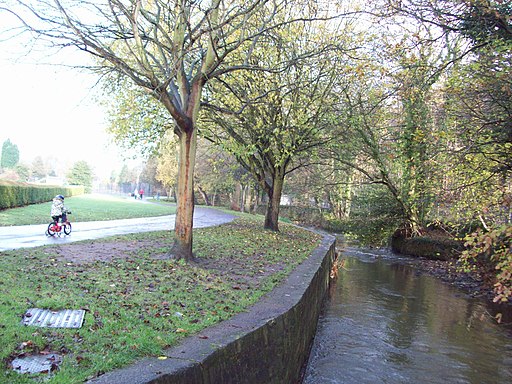
River Sheaf Walk
![]()
![]() Follow the River Sheaf from Sheffield to Beauchief on this pleasant waterside walk in Yorkshire.
Follow the River Sheaf from Sheffield to Beauchief on this pleasant waterside walk in Yorkshire.
The waymarked trail starts from Granville Square in the city centre of Sheffield, just south of the train station, near the river's confluence with the River Don. The 5 mile trail then heads south west passing Hutcliff Wood, Millhouses Park and Abbeydale before finishing near Beauchief. Here you could visit Beauchief Abbey, a medieval monastic house with parkland and ancient ruins to see. Millhouses Park is also worth exploring with its woodland, river trails and attractive boating lake to see.
As of time of writing there are also talks for a Sheaf Valley Cycle Route which would run from the City Centre to Woodseats Road via Shoreham Street and Little London Road. You can see more information by clicking here.
To continue your waterside walking in the city you could try the popular Five Weirs Walk and the Sheffield Canal Walk which starts at the nearby Canal Basin.
River Sheaf Walk Ordnance Survey Map  - view and print off detailed OS map
River Sheaf Walk Open Street Map  - view and print off detailed map
River Sheaf Walk OS Map  - Mobile GPS OS Map with Location tracking
River Sheaf Walk Open Street Map  - Mobile GPS Map with Location tracking
Cycle Routes and Walking Routes Nearby
Photos
River Sheaf Walk Information Point, Sheaf Bank, Heeley, Sheffield. The river used to provide the power for metal works such as the Grade I-listed Abbeydale Industrial Hamlet.
The River Sheaf emerges from its culvert to join the River Don by Blonk Street Bridge, Sheffield, England


