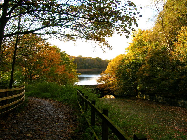
Rivington Reservoir
![]()
![]() Enjoy a stroll along the Rivington Reservoirs on this waterside walk in Rivington Country Park, near Bolton.
Enjoy a stroll along the Rivington Reservoirs on this waterside walk in Rivington Country Park, near Bolton.
The walk starts from the Rivington Hall Barn car park at the southern end of the lower reservoir. The barn is a popular tourist attraction and may date as far back as the 9th and 13th centuries, but is more likely to be from the 16th century. It was restored, altered and enlarged in 1905 by Jonathan Simpson for Lord Leverhulme. You can purchase refreshments here before or after your exercise.
From here you follow paths west towards the reservoir and the replica of Liverpool Castle. It was commissioned in 1912 by Lord Leverhulme, a philanthropist and the founder of Lever Brothers (now Unilever). It was never completed but the atmospheric ruins still remain. In this area there's also some attractive lakeside woodland where you can see lots of bluebells in the spring months.
The walk then follows footpaths north along the water towards the Upper Reservoir and the smaller Yarrow Reservoir. Here you cross to the other side along Knowsley Lane, where you can follow another path south along the western side of the Upper Reservoir. You then cross back on Horobin Lane which leads to the village of Rivington where there's the pretty green, the primary school and the little church. On the green you can see the village stocks which are inscribed 'T W 1719' on the stone base. The church warden and village constable patrolled the village and anyone disregarding the sanctity of the sabbath would be bound in them. The area is part of the wider Lever Park, a designed landscape between the open moorland and the chain reservoirs and is 'one of the largest and most impressive examples of landscape design in Edwardian England'.
After exploring the village the route follows the waterside paths back to the car park.
The walk can be extend by continuing north and visiting the adjacent Anglezarke Reservoir.
To continue your walking in the park try the popular climb to Rivington Pike. The route includes a visit the lovely terraced gardens before enjoying wide ranging views over the West Pennine Moors from the hill summit. There's also the climb to Winter Hill which starts nearby.
Rivington Reservoir Ordnance Survey Map  - view and print off detailed OS map
Rivington Reservoir Open Street Map  - view and print off detailed map
Rivington Reservoir OS Map  - Mobile GPS OS Map with Location tracking
Rivington Reservoir Open Street Map  - Mobile GPS Map with Location tracking
Pubs/Cafes
On the eastern side of the water in Rivington village you could enjoy some refreshments in the delightful Rivington Village Green Tea Room. There's a cosy interior where you can enjoy a good range of snacks and meals. There's also an outdoor area for warmer days and the cafe is very dog friendly too. You can find the tea rooms on Sheep House Lane with a postcode of BL6 7SD for your sat navs.
Further Information and Other Local Ideas
To the north is the Brinscall Walk which follows a nice trail along The Goit Canal to White Coppice and Anglezarke Reservoir. The Withnell Nature Reserve and the Abbey Village Reservoir can also be accessed near the route.
To the west of Bolton there's a nice circular trail to be found around High Rid Reservoir. The small lake is a good place for spotting wildfowl.
For more walking ideas in the area see the Lancashire Walks and West Pennine Moors Walks pages.


