Roche Abbey Walk
![]()
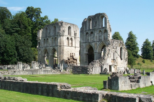
![]() Explore the atmospheric ruins of Roche Abbey on this short walk in Maltby. The Grade II listed abbey was founded in 1147 and is now in the care of English Heritage.
Explore the atmospheric ruins of Roche Abbey on this short walk in Maltby. The Grade II listed abbey was founded in 1147 and is now in the care of English Heritage.
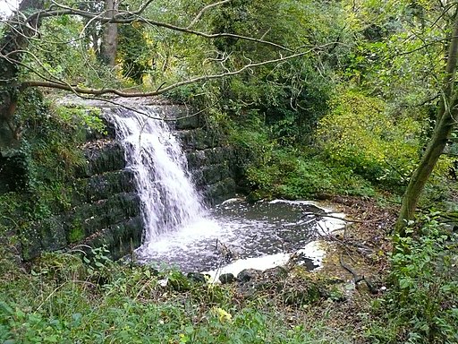
The abbey is surrounded by attractive grounds with nice footpaths taking you to woodland, ponds and hills. The grounds were landscaped by 'Capability' Brown in the 18th Century and include a pretty stream with four waterfalls.
You can start the walk from the car park next to the ruins. Then pick up the paths around the site to appreciate the remaining fine gothic architecture. This includes the surviving transept walls, the ruined hall and a section of the gatehouse.
After exploring the site you can follow the paths past the pretty waterfall at Laughton Pond and up into the Slade Hills for nice views over the area. There's also the option of continuing along the paths to the nearby village of Laughton-en-le-Morthen. Here you can visit the fine church with its distinctive spire and enjoy refreshments at one of the nice pubs. Alternatively you can bring a packed lunch and enjoy it in the on site picnic area.
The abbey is located only about a mile south of Maltby. You could use the town as an alternative start point and reach the site by following footpaths along the Maltby Dike.
In Maltby you can pick up the Danum Trail. The long distance footpath explores the beautiful Yorkshire countryside surrounding Doncaster and Rotherham.
You're also not far from Rother Valley Country Park where you can enjoy 5 pretty lakes, views of the River Rother and a nature reserve which boasts the recording of over 260 different varieties of birds over the past two decades. Harthill Reservoir and Pebley Reservoir are also located just east of here.
Postcode
S66 8NW - Please note: Postcode may be approximate for some rural locationsPlease click here for more information
Roche Abbey Ordnance Survey Map  - view and print off detailed OS map
Roche Abbey Open Street Map  - view and print off detailed map
Roche Abbey OS Map  - Mobile GPS OS Map with Location tracking
Roche Abbey Open Street Map  - Mobile GPS Map with Location tracking
Pubs/Cafes
There's an on site vending machine and a shop selling crisps, cold drinks and confectionery. There's also picnic areas if you would like to bring your own refreshments.
Dog Walking
The area is a lovely place for a dog walk. You will probably see other owners on your visit.
Cycle Routes and Walking Routes Nearby
Photos
Roche Abbey Gatehouse. View through the triple-portal gatehouse from inside the Abbey precinct to the outside. Built c1200, it is the oldest Cistercian gatehouse surviving.


