Sandwood Bay Walk
![]()
![]() Visit one of the most beautiful beaches in Great Britain on this wonderful walk in Sutherland. The route follows a 4 mile track from Blairmore, passing a series of pretty lochs through peat moorland to the coast.
Visit one of the most beautiful beaches in Great Britain on this wonderful walk in Sutherland. The route follows a 4 mile track from Blairmore, passing a series of pretty lochs through peat moorland to the coast.
The walk starts at the car park in the little hamlet of Blairmore and soon picks up the trail to the coast. You'll first pass Loch Aisir, Loch na Gainimh and Loch a Mhuilinn before the wonderful stretch of coast comes into view. There's great views of the Cape Wrath cliffs and the lovely Sandwood Loch on this final section. The beach is absoultely stunning with sand dunes, cliffs and an unusual sea stack named Am Buachaille. It's about a mile long so you can enjoy a long stroll along the beach before heading back to Blairmore on the same path.
The Sandwood coast is a great place for wildlife spotting. Look out for dolphins and a variety of birds including Guillemots, Razor Bills and Shags.
Postcode
IV27 4RT - Please note: Postcode may be approximate for some rural locationsPlease click here for more information
Sandwood Bay Ordnance Survey Map  - view and print off detailed OS map
Sandwood Bay Open Street Map  - view and print off detailed map
*New* - Walks and Cycle Routes Near Me Map - Waymarked Routes and Mountain Bike Trails>>
Sandwood Bay OS Map  - Mobile GPS OS Map with Location tracking
Sandwood Bay Open Street Map  - Mobile GPS Map with Location tracking
Pubs/Cafes
You could head into the nearby village of Kinlochbervie and visit the Old School Restaurant. There are great views over the Atlantic Ocean and Loch Inchard from here.
There's also the Worth A Look cafe which sells hot & cold snacks & drinks, ice cream and gifts. Postcode for your sat navs is IV27 4RE.
Dog Walking
The beach is a nice place for a dog walk but its advised to keep them under control as there are sheep in the area.
Photos
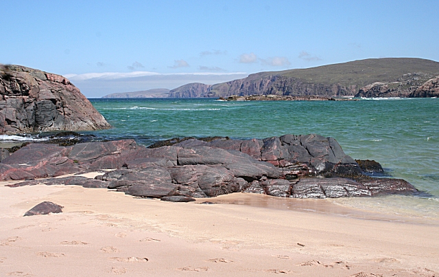
Sandwood Bay. The outcrops of rock in the middle of the bay are of Lewisian gneiss, which is up to 3000 million years old, give or take a hundred million or few. The most distant headland in this view is Cape Wrath, 11 miles to the north. The bay is backed by an extensive belt of dunes, most of which are stabilised by marram grass.
The ruins of the house at Sandwood command a fine view towards Sandwood Loch, with a glimpse of the beach beyond the dunes at left. The walls of the house, like the surrounding dykes, still stand almost intact, though the roof and woodwork have vanished.
The cliffs at the south end of the bay, and the sea stack Am Buachaille, meaning 'the Herdsman', are of Torridonian sandstone. The foreground rocks here are Lewisian gneiss, so there is a change of rock type, and an age difference of more than a thousand million years, between the foreground and background in this view.
The stack is 65 metres (213 feet) high and was first climbed in 1968 by the mountaineers Tom Patey, Ian Clough and John Cleare. It is considered a "famous" sea stack climb with at least four routes to the top.
On the left is the more northerly of the two rocky outcrops on the beach. The map shows that it is accessible at low tide, but it's well offshore at this state of the tide.
Tràigh Shanabhait. A classic view of Sandwood Beach, with distant Am Buachaille guarding the southern extremity of the bay.
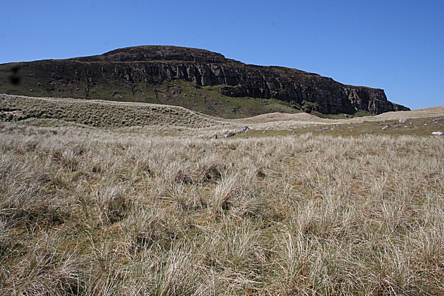
Druim na Buainn. The cliffs above the south end of the bay are Torridonian Sandstone. Marram grass covers much of the sand dunes by the beach. The area contains a wide variety of other flora with more than 200 different species of plant, including eight types of orchid. The peatlands of Sandwood are among the most important wildlife habitats in north-west Scotland.


