Scafell Pike Walk - Easiest Route
![]()
![]() Climb the highest mountain in England on this spectacular walk in the Lake District. Scafell pike stands at a height of 978 metres (3,209 ft) between Eskdale and Wasdale, at the northern end of Wast Water.
Climb the highest mountain in England on this spectacular walk in the Lake District. Scafell pike stands at a height of 978 metres (3,209 ft) between Eskdale and Wasdale, at the northern end of Wast Water.
The route below is the shortest, most direct way to the summit. Although still very challenging it is probably the easiest route up to Scafell Pike. It starts from the car park at Lake Head Car Park, Wasdale and heads east to Lingmell Gill, Lingmell Scars and Hollow Stones before finishing at the highest point where you will find an Ordnance Survey triangulation column beside a huge cairn. The views are stunning with the coast, the Isle of Man and Snowdonia all visible on a clear day.
For a different, more scenic route to the summit you can try the Scafell Pike from Borrowdale route. This longer route takes you around Styhead Tarn and along the famous Corridor Route. The Scafell Pike from Langdale route is another popular route. It is a longer and more challenging climb, but with some wonderful views of the Langdale Valley and a visit to Angle Tarn.
Another great climb also starts from Wasdale Head. The circular climb to Pillar is a splendid walk taking you to the eighth highest point in the Lake District.
Please click here for more information
Scafell Pike Ordnance Survey Map  - view and print off detailed OS map
Scafell Pike Open Street Map  - view and print off detailed map
Scafell Pike OS Map  - Mobile GPS OS Map with Location tracking
Scafell Pike Open Street Map  - Mobile GPS Map with Location tracking
Pubs/Cafes
Head to the Wasdale Head Inn for some well earned post walk refreshments. Described as the the birthplace of climbing the inn has an interesting history stretching back over 200 years. They do very good food and have a decent selection of ales too. It's located close to the car park at postcode CA20 1EX for your sat navs. The inn is also dog friendly and will provide water bowls for your thirsty friend.
Cycle Routes and Walking Routes Nearby
Photos
Scafell from Scafell Pike. The "ridge" of Mickledore in centre frame, crossing to Broad Stand.
As you climb, the lower slopes are characterised by grasslands and heather moorland, featuring species like bilberry, crowberry, and native grasses. These areas also host small mammals such as voles and red squirrels. Further up, the conditions become harsher, with scree slopes and rocky outcrops supporting resilient plants like mosses, lichens, and the rare Alpine Clubmoss, which thrive in these high-altitude, nutrient-poor environments.
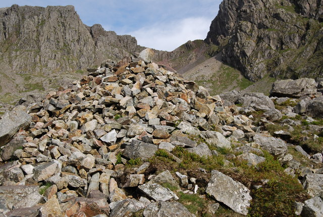
Cairn amongst a boulderfield on Scafell Pike. Cairns are essential to beable to follow the path on an otherwise featureless landscape.
Birdlife is a highlight on this route, with ravens and peregrine falcons commonly seen soaring above. The elusive ring ouzel, often called the "mountain blackbird," can sometimes be spotted. On calmer days, deer may be glimpsed on the lower slopes, particularly red deer. In addition, streams and small tarns along the route occasionally support aquatic life such as trout.
Elevation Profile


