Slieve Gullion Walk Map
![]() This walk climbs to Slieve Gullion the highest point in County Armagh. It's the short route to the summit, approaching from the western side.
This walk climbs to Slieve Gullion the highest point in County Armagh. It's the short route to the summit, approaching from the western side.
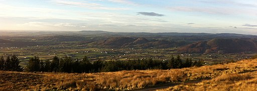
You can start the walk from the car park at the Slieve Gullion Viewing Platform on Longfield Road. Then follow a winding footpath east to the summit which stands at a height of 573 metres (1,880 ft). At the top you can enjoy far reaching views to Antrim, Dublin Bay and Wicklow. There's also a small lake and two ancient burial cairns to see here.
There's also a waymarked trail from the northern side of the mountain. To extend the walk you could follow it north to visit Calliagh Berras Lough, the highest lough in Northern Ireland.
The mountain is part of the wider Ring of Gullion Ring of Gullion where there is a fantastic loop walk which runs for nearly 10 miles across the geologically fascinating heather moorland.
Postcode
BT35 9TX - Please note: Postcode may be approximate for some rural locationsPlease click here for more information
Slieve Gullion Open Street Map  - view and print off detailed map
*New* - Walks and Cycle Routes Near Me Map - Waymarked Routes and Mountain Bike Trails>>
Slieve Gullion Open Street Map  - Mobile GPS Map with Location tracking
Further Information and Other Local Ideas
To continue your walking around County Armagh you could head to Gosford Forest Park where there's miles of woodland trails, streams, waterfalls, ponds, grassland and a lovely arboretum to visit. There's also Peatlands Park where there's several colour coded walks taking you around the 680 acre site. The park consists of peatlands, orchards, woodland, boardwalks and two nature reserves.
To the north there's some fine waterside walking at Camlough Lake. The large reservoir has some nice footpaths and fine views over the water to Camlough Mountain.
For more walking ideas in the area see the Northern Ireland Walks page.
Cycle Routes and Walking Routes Nearby
Photos
Road to Slieve Gullion. If you don't wish to walk up Slieve Gullion there is a mountain road that ends quite close to the summit and offers great views. This is looking back down the road towards Dundalk Bay in the far distance (not visible).
The summit of Slieve Gullion is a huge burial cairn. One of the summit cairns is the highest surviving passage grave in Ireland. On top is the trig point at 1,894ft (573m) and a range finder. On a clear day views of up to around 100 miles are possible.
Calliagh Berras Lough. Calliagh Berras Lough, on the northern summit of Slieve Gullion, is the highest Lough in N. Ireland at 545m above sea level. The pool is named in honour of a woman famed in local folklore for bewitching the giant Finn McCool. She tricked him into diving in to the lough, and when he surfaced his blonde hair had turned completely white. Legend has it that the same fate will befall any person who swims in the waters today.


