Smiddy Shaw Reservoir
![]()
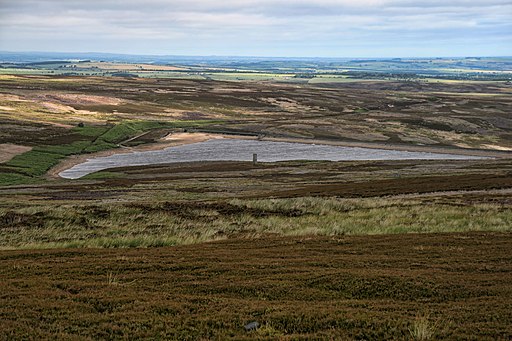
![]() This walk visits Smiddy Shaw Reservoir on Muggleswick Common near Consett in County Durham.
This walk visits Smiddy Shaw Reservoir on Muggleswick Common near Consett in County Durham.
There's a nice gravel footpath running around the reservoir with fine views across the water to the surrounding fields. You can start the walk from the public car park located at the eastern end of the water, near to Blackpool Hill.
It's easy to extend your reservoir walking by heading south to the Waskerley Reservoir Way or west to Hisehope Reservoir. Tunstall Reservoir is only a few miles to the south as well.
Postcode
DH8 9DZ - Please note: Postcode may be approximate for some rural locationsSmiddy Shaw Reservoir Ordnance Survey Map  - view and print off detailed OS map
Smiddy Shaw Reservoir Open Street Map  - view and print off detailed map
Smiddy Shaw Reservoir OS Map  - Mobile GPS OS Map with Location tracking
Smiddy Shaw Reservoir Open Street Map  - Mobile GPS Map with Location tracking
Pubs/Cafes
Nana B's Teas is located just to the east of the reservoir on the Waskerley Way. They serve a good range of meals and snacks in lovely surroundings. You can find them at postcode DH8 9HR just over a mile east of the reservoir. They are dog friendly with a water bowl available.
Further Information and Other Local Ideas
For more walking ideas in the area see the North Pennines Walks page.


