St Abbs Head Coastal Walk
![]()
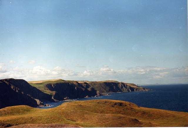
![]() This walk in the Scottish Borders follows a section of the Berwickshire Coastal Path to St Abbs Head and lighthouse. It's a rugged stretch of coast with some interesting rock formations and fine sea views.
This walk in the Scottish Borders follows a section of the Berwickshire Coastal Path to St Abbs Head and lighthouse. It's a rugged stretch of coast with some interesting rock formations and fine sea views.
You can pick up the coastal path in the village and then follow it north to Starney Bay, Bell Hill and Horecastle Bay to the headland. Here you'll find the remains of St Abb's Kirk and a fine viewpoint. The area is great for wildlife with thousands of sea birds to see. Keep your eyes peeled for Guillemots, Kittiwakes, Puffins, Razorbills and even dolphins as you make your way along the cliff path. Slightly inland there's also the Mire Loch with swans, ducks, damselflies and butterflies.
The site also includes a visitor centre, coffee shop, art gallery and textile shop. There's some fine exhibitions in the Nature Centre where you can learn all about the wildlife, geology and history of the headland.
Just west of St Abbs Head you'll find the historic Fast Castle. The photogenic ruins of the 14th century structure are located in a fine spot on a rocky headland overlooking the sea. You can follow the Berwickshire Coastal Path to the site at Dowlaw.
Postcode
TD14 5QF - Please note: Postcode may be approximate for some rural locationsPlease click here for more information
St Abbs Ordnance Survey Map  - view and print off detailed OS map
St Abbs Open Street Map  - view and print off detailed map
*New* - Walks and Cycle Routes Near Me Map - Waymarked Routes and Mountain Bike Trails>>
St Abbs OS Map  - Mobile GPS OS Map with Location tracking
St Abbs Open Street Map  - Mobile GPS Map with Location tracking
Pubs/Cafes
In St Abbs village there's Ebbcarrs Cafe for some refreshments. You can sit outside here and enjoy a view over the harbour with your meal. You can find them at postcode TD14 5PW.
There's also the Contented Sole located in a lovely spot by the harbour in the nearby village of Eyemouth. They serve fine seafood which you can enjoy outside with a view of the water. You can find them at postcode TD14 5HS for your sat navs.
Dog Walking
Some of the cliffs are very high so it's best to keep dogs on leads in these areas. The Contented Sole mentioned above is dog friendly.
Further Information and Other Local Ideas
The Eyemouth to St Abbs Walk will take you along the coast path to the headland from the nearby town. Eyemouth is well worth a visit, with its picturesque harbour and the historic Gunsgreen House to see.
Head inland and there's some pleasant waterside trails along Whiteadder Reservoir in the Lammermuir Hills of East Lothian. Near here you can also visit Edin's Hall Broch where you can explore the historic remains of a 2nd century broch while enjoying some fine views over the area.
The Coldingham Bay to St Abbs and Coldingham Loch Walk will take you on to the pretty Coldingham Loch and into the village of the same name.
Cycle Routes and Walking Routes Nearby
Photos
St Abbs Lighthouse. The light is at 255 feet and is reached by a flight of steps leading down the cliff from the lightkeepers' house above. Originally the light was oil powered, converted to electric operation in 1966 and automated in 1993. It was designed and built by the brothers David Stevenson and Thomas Stevenson and began service on 24 February 1862


