Standing Hat and Balmer Lawn
![]()
![]() This easy circular walk takes you through Forestry Commission managed Inclosures near Brockenhurst in the New Forest. You can park at the car park at Balmer Lawn and then follow good footpaths through the delightful woodland in the Pignal Inclosure. It's a lovely spot for an easy, peaceful stroll. Look out for the New Forest Ponies on your walk.
This easy circular walk takes you through Forestry Commission managed Inclosures near Brockenhurst in the New Forest. You can park at the car park at Balmer Lawn and then follow good footpaths through the delightful woodland in the Pignal Inclosure. It's a lovely spot for an easy, peaceful stroll. Look out for the New Forest Ponies on your walk.
If you'd like to try more easy walks near Brockenhurst then the Ober Water Walk and the Blackwater Arboretum Trail are both good options.
Just to the north east the route can be extended by heading into Denny Wood.
Postcode
SO42 7ZB - Please note: Postcode may be approximate for some rural locationsStanding Hat Ordnance Survey Map  - view and print off detailed OS map
Standing Hat Open Street Map  - view and print off detailed map
Standing Hat OS Map  - Mobile GPS OS Map with Location tracking
Standing Hat Open Street Map  - Mobile GPS Map with Location tracking
Pubs/Cafes
The Balmer Lawn Hotel is a great place to visit in the area. The exquisite building is surrounded by picturesque parkland and gardens. They are well known for their delicious afternoon tea which you can enjoy on the front terrace.
Dog Walking
As you'd imagine the woodland trails are a fine place for a dog walk. The Balmer Lawn Hotel mentioned above is also dog friendly.
Further Information and Other Local Ideas
Hollands Wood is located just north of Balmer Lawn and has a good campsite and a decent bridleway suitable for cyclists.
For more walking ideas in the area see the Hampshire Walks and the New Forest Walks pages.
Cycle Routes and Walking Routes Nearby
Photos
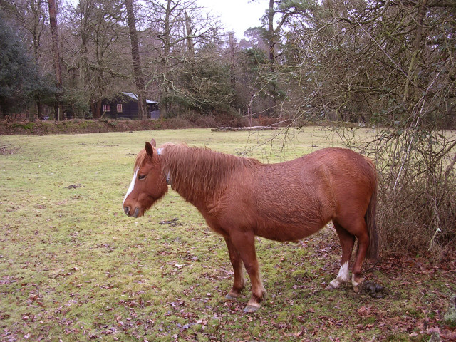
Wet pony. Between Balmer Lawn and the Pignal Inclosures is a area of open woodland called Standing Hat (a holly and oak holm). This photo is looking south from the Forestry Commission car park (closed to give the site a rest in the winter), towards one of the private dwellings in the Pignalhill Inclosure. The pony in the picture is wearing a reflective collar, which will make it a lot easier for Forest motorists to spot at night.
Pignal Inclosure from Standing Hat. The Forestry Commission car park at Standing Hat provides the most convenient access to the vast area of enclosures northwest of Brockenhurst. This view over a gate into the Pignal Inclosure shows two of the off-road cycle paths which (being gravelled) provide a dry winter walk through the plantations. The path on the left eventually leads to Clayhill south of Lyndhurst. There is some distortion at the edges due to the slightly "wide angle" lens on my compact camera.
Driftway between Parkhill Inclosure and Stubby Copse Inclosure in late summer. This view is looking north along the driftway which connects Standing Hat to Denny Wood. There are several driftways in this part of the Forest, which are essentially wide areas left between the numerous enclosures so that the Commoners' stock can freely move from one part of the Forest to another.
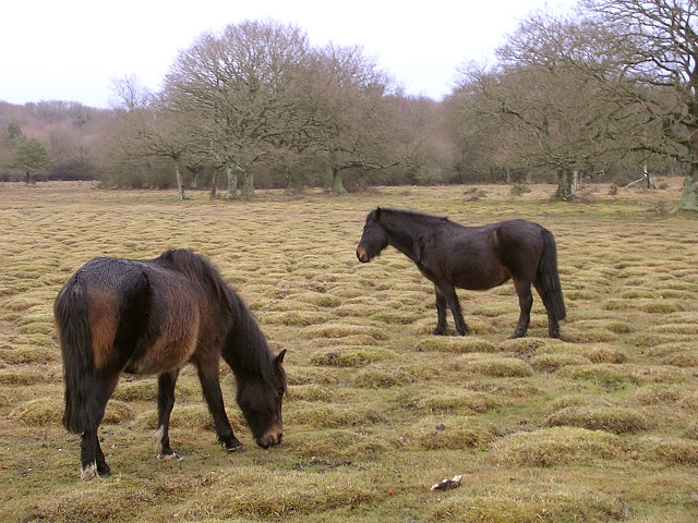
Ponies grazing on Balmer Lawn. Balmer Lawn is a large area of open lawn surrounded on three sides by woodland. The area was once far wetter and as a result of partial drainage and some shrinkage of the ground, the old purple moor grass tussocks have consolidated and with grazing have given the unusual 'hummock-scape' seen here. [Information from Discovering the New Forest by Terry Heathcote]


