Stockton on the Forest Walks
![]()
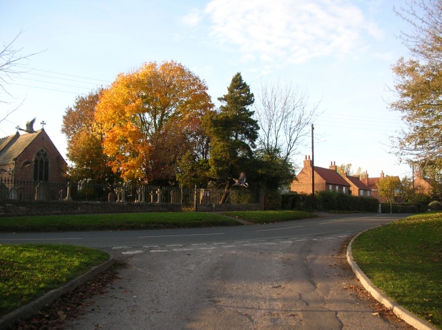
![]() This little village is located a few miles north east of the city of York. There's some nice local trails to follow around some attractive farmland.
This little village is located a few miles north east of the city of York. There's some nice local trails to follow around some attractive farmland.
This circular walk from the village visits the neighbouring settlements of Warthill and Holtby.
The walk starts in the village and follows Carrbank Lane through pleasant farmland towards Warthill where there's a nice village pond, a good local pub and an old church. You then head west along Rudcarr Lane before turning south to visit Holtby.
The route then returns to Stockton via the farmland around Beanland Lane.
Postcode
YO32 9UW - Please note: Postcode may be approximate for some rural locationsStockton on the Forest Ordnance Survey Map  - view and print off detailed OS map
Stockton on the Forest Open Street Map  - view and print off detailed map
Stockton on the Forest OS Map  - Mobile GPS OS Map with Location tracking
Stockton on the Forest Open Street Map  - Mobile GPS Map with Location tracking
Walks near Stockton on the Forest
- York River Walk - Enjoy an easy stroll along the River Ouse on this waterside circular walk through York
- York Walls Walk - This walk takes you around the city walls in the historic city of York
- Foss Walk - Follow the River Foss, from the historic city of York to Easingwold, on this lovely riverside walk through Yorkshire
- Ebor Way - Follow the Ebor Way from Helmsley to Ilkley on this walk through Yorkshire
- York to Selby - This lovely cycle and walk route starts on the banks of the River Ouse in the city of York and follows the Trans Pennine Trail and the York to Selby Railway Path south to Selby.
The mostly flat, off road route is ideal for a relaxing afternoon's cycling or walking and has views of York racecourse and the River Ouse - York to Bishopthorpe - This is a popular riverside walk from the centre of York to the nearby village of Bishopthorpe
- Naburn Locks - This walk visits the pretty Naburn Locks on the River Ouse, just south of the city of York.
- Minster Way - This splendid walk runs between the well known minsters at Beverley and York, visiting Arram, Scorborough, North Dalton, Lockington, Millington, Great Givendale, Bishop Wilton, Full Sutton, Stamford Bridge, Kexby and Fulford
- Wheldrake Woods - These pretty woods near York have some lovely peaceful walking trails to try.
- Bishop Wilton - This pretty little village in the East Riding of Yorkshire is a pleasant place to start a walk into the Yorkshire Wolds
- Stamford Bridge - This historic village is located in the East Riding of Yorkshire
- Strensall Common - Strensall Common lies just to the east of the North Yorkshire village of Strensall.
- Acaster Malbis - This small Yorkshire village sits a few miles south of York on the River Ouse.
Pubs/Cafes
Back in the village the Fox Inn is a good choice for some post walk refreshment. The friendly village pub serves good quality food and has an outdoor seating area. You can find them at postcode YO32 9UW for your sat navs.
Dog Walking
The country trails make for a fine dog walk and the Fox Inn mentioned above is also dog friendly.
Further Information and Other Local Ideas
Head into nearby York and you can pick up the popular York River Walk and the historic York Walls Walk.
Photos
Warthill village pond. This pond is sat opposite the Agar Arms in Warthill and across the road from the church. A small track starts here leading across to Gate Helmsley.


