Strawberry Line (Yatton to Cheddar)
![]()
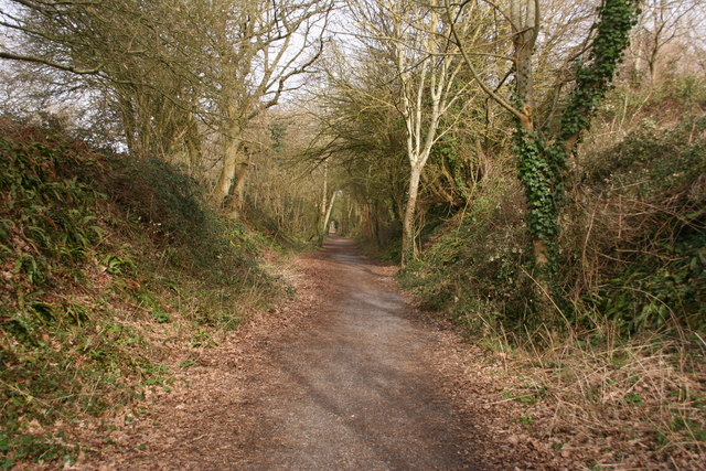
![]() This splendid walk and cycle path runs along a former railway line that used to transport strawberries from Cheddar.
This splendid walk and cycle path runs along a former railway line that used to transport strawberries from Cheddar.
You start by Yatton railway station and head south passing Congresbury and Axbridge before finishing in Cheddar. The route passes apple orchards, open fields and the River Yeo while there are also pleasant woodland sections at King's Wood and Rose Wood. Also on the route is the delightful Millennium Green at Winscombe (perfect place to stop for lunch!) and the tranquil Cheddar Reservoir at the end of the route.
If you have time you could continue up to the magnificent Cheddar Gorge and see this spectacular natural wonder.
Axbridge is also well worth exploring with its medieval town square, half timbered buildings and the Tudor King John's Hunting Lodge which houses a fine local museum.
The route is part of National Cycle Route 26 which runs from Portishead in Somerset to the Isle of Portland on the south coast of Dorset. You can extend your outing on this signed Sustrans path if you have time.
Please click here for more information
Strawberry Line (Yatton to Cheddar) Ordnance Survey Map  - view and print off detailed OS map
Strawberry Line (Yatton to Cheddar) Open Street Map  - view and print off detailed map
Strawberry Line (Yatton to Cheddar) OS Map  - Mobile GPS OS Map with Location tracking
Strawberry Line (Yatton to Cheddar) Open Street Map  - Mobile GPS Map with Location tracking
Pubs/Cafes
In Congresbury you could stop off at The Plough Inn. The lovely old pub dates back to the 1800s and includes a homely interior with a real log fire. Outside there's a nice large sunny garden for warmer days. They serve good quality food and can easily be found on the High Street at postcode BS49 5JA for your sat navs. They're also dog friendly if you have your canine friend with you.
Further Information and Other Local Ideas
Near Congresbury there's the wonderful Goblin Combe to visit. This scenic nature reserve includes hundreds of acres of woodland, large areas of open grassland, limestone cliffs and some moderate climbs with great views towards the Mendip Hills. It's one of the highlights of the area and makes a great extension to your outing.
You can also enjoy a riverside walk along the Yeo on the Two Rivers Way to nearby Wrington.
For more walking ideas in the area see the Somerset Walks page.
Cycle Routes and Walking Routes Nearby
Photos
The start of the Strawberry Line. For almost a century, the 'Strawberry line' carried fruit and passengers from Cheddar over the Mendips and across the Somerset Levels to join the main line at Yatton. Today it has been transformed into a cycle route and footpath which follows the old railway line. This part is maintained by the Yatton & Congresbury Wildlife Action Group
The old station. Among the weeds we can just see the old railway station platforms at the former G W R station which is now part of this very popular cycle route that brings bikers and walkers from a large surrounding area. You will note the station sign though not original is more or less a faithful copy.
Elevation Profile
.jpg)


