Symondsbury Walks
![]()
![]() This pretty village lies just to the west of the town of Bridport in Dorset. It's a nice place to start a walk with the countryside of the Marshwood Vale and the wonderful Jurassic Coast to explore on foot. There's an ancient church, several picturesque thatched cottages and a historic pub dating to the 1400s, where you can enjoy some post exercise sustenance.
This pretty village lies just to the west of the town of Bridport in Dorset. It's a nice place to start a walk with the countryside of the Marshwood Vale and the wonderful Jurassic Coast to explore on foot. There's an ancient church, several picturesque thatched cottages and a historic pub dating to the 1400s, where you can enjoy some post exercise sustenance.
This route from the village uses sections of the Monarch's Way and the South West Coast Path to create a circular walk through the surrounding area. On the way you'll visit several of the local highlights including the viewpoint at Colmers Hill, the pretty coastal village of West Bay and the neighbouring town of Bridport.
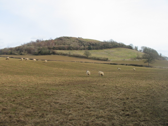
The walk starts in the village and heads a short distance to the west to climb to Colmers Hill. From the top of the distinctive hill there are fine views towards the coast and countryside.
You can then can pick up country tracks heading south across Eype Down to the coast at Hope Corner. Here you can pick up the coastal path and follow it east to West Bay.
At West Bay you pick up the Monarch's Way and head north along the River Asker to Bridport.
The route continues north east past Walditch before turning north west to St Andrew's Well and Watton Hill. Continue west past Pymore and Bilshay Lane before turning south to return to the village.
Postcode
DT6 6HD - Please note: Postcode may be approximate for some rural locationsSymondsbury Ordnance Survey Map  - view and print off detailed OS map
Symondsbury Open Street Map  - view and print off detailed map
Symondsbury OS Map  - Mobile GPS OS Map with Location tracking
Symondsbury Open Street Map  - Mobile GPS Map with Location tracking
Walks near Symondsbury
- Colmers Hill - Enjoy a climb to Colmers Hill and enjoy wonderful views over the Dorset countryside and coast
- West Bay to Seatown - A lovely section of the Jurassic Coast between the Dorset villages of West Bay and Seatown
- Bridport - This varied circular walk from the town takes you to several of the highlights of the area including the delightful quay at West Bay, Bothenhampton Hill, the River Brit and the River Asker
- Langdon Hills Country Park - This splendid country park in Basildon includes 400 acres of meadows, farmland and woodlands with an abundance of wildlife from Green Winged Orchids to the Great Crested Newt
- Circular Walk from West Bay Dorset - Enjoy some splendid coastal views on this walk from the village of West Bay in Dorset
- Jurassic Coast - Walk the entire length of the spectacular Jurassic Coast on this epic route in south west England
- Eggardon Hill - Climb to this Iron Age hill fort and enjoy wonderful views over Marshwood Vale on this hilltop walk near Bridport.
The walk starts from the roadside parking area shown on the google street view link below - Golden Cap Estate - Enjoy miles of beautiful woodland, countryside and coastal walking trails in this stunning section of the Dorset AONB. The Golden Cap Estate is located between Bridport and Charmouth on the Dorset coast
- Burton Bradstock - There are a number of lovely coastal walking trails around this pretty National Trust run estate in Dorset.The estate is part of the Jurassic Coast and includes cliff-top trails along Burton cliff and the popular shingle Hive beach
- Lamberts Castle to Coneys Castle - Enjoy wonderful views over Dorset's beautiful Marshwood Vale on this circular walk near Bridport
- Shipton Gorge - This small village is located just east of Bridport in the county of Dorset
Pubs/Cafes
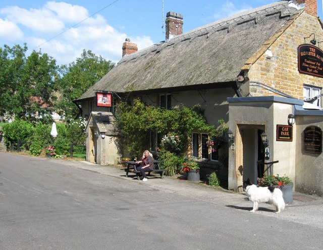
Back in the village you can enjoy some well earned rest and refreshment at the Ilchester Arms. The historic thatched inn dates from the 15th century and includes oak beams and a huge open fireplace. Other features include a car park, skittle alley and a lovely lawned garden for the warmer months. You can find them at postcode DT6 6HD for your sat navs.
Dog Walking
The country and coast trails make for a fine dog walk. The Ilchester Arms mentioned above is also dog friendly.
Further Information and Other Local Ideas
Just a couple of miles to the east of Bridport there's Shipton Gorge where you can enjoy a climb to Shipton Hill and visit the splendid 15th century church of St Martin.
Photos
Symondsbury village from Colmers Hill. Picture of this pretty village taken from the top of nearby Colmers Hill. In historical times the main economy of the village was the production of flax and hemp for Bridport's rope and net manufacturing trade. Records show that the first rector arrived in 1325 in St John the Baptist church. More information about the village can be found in this
Inner harbour, West Bay Bridport Harbour, as it used to be known, was built in 1740 and visited by as many as 500 shops a year during the 19th century. Sluice gates, added in 1823, enable a torrent of river water to be released to scour sand and shingle from the entrance channel. Schooners and other ships, including naval vessels, were built at West Bay until 1879.


