Tamar Valley Discovery Trail
29.8 miles (48 km)This long-distance walk follows the Tamar Valley Discovery Trail through the Tamar Valley Area of Outstanding Natural Beauty, linking Tamerton Foliot in Devon with Launceston in Cornwall.
The route explores one of the most unspoilt river valleys in southern England, following historic waterways, quiet countryside and former industrial landscapes shaped by mining, agriculture and river trade.
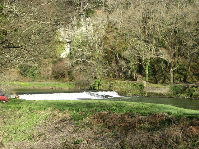
From Tamerton Foliot the trail heads north towards the Lopwell area, crossing the River Tavy and entering the Lopwell Dam Nature Reserve.... This protected site supports a wide range of habitats including mudflats, freshwater marsh, saltmarsh, wildflower meadows, scrub and semi-natural woodland. The mix of tidal and freshwater environments makes it an important area for wildlife, with regular sightings of wading birds, kingfishers, otters and a rich variety of plant life throughout the year.
Beyond Lopwell, the route continues north to join the River Tamar, the historic boundary between Devon and Cornwall. The riverside walking through Calstock offers expansive views across the wooded valley slopes and passing boats on the water below. The trail then follows the Tamar upstream through Gunnislake and the village of Luckett, an area closely associated with the region’s copper mining past and now recognised as part of the Cornwall and West Devon Mining Landscape World Heritage Site.
Leaving the river, the walk passes inland through rolling farmland and quiet lanes around Milton Abbot, with views back across the Tamar Valley and surrounding countryside. The route later crosses the river again at Dunterton before continuing north towards Launceston, an ancient market town dominated by its Norman castle. This final section provides a strong sense of arrival, contrasting the secluded river valley with the historic town at the head of the Tamar.
Overall, the Tamar Valley Discovery Trail offers a varied and rewarding walk, combining riverside paths, nature reserves, historic villages and wide-ranging valley views. It is particularly well suited to walkers interested in landscape, wildlife and industrial heritage, and can be tackled in sections or enjoyed as a full end-to-end journey through this distinctive borderland between Devon and Cornwall.
Pubs and More Info
In Calstock you could head to the Tamar Inn for refreshments on the walk. The historic 17th century free house sits on the banks of the River Tamar. It was allegedly once a meeting place for smugglers and highwaymen. Built on a split level, it sits close by the waterfront in the village centre at a postcode of PL18 9QA.
Near Gunnislake there's the excellent Rising Sun Inn. The charming, oak beamed country pub dates back to the 17th century. They have some lovely terraced gardens where you can enjoy a meal with a view over the Valley. You can find them at postcode PL18 9BX for your sat navs. The inn is dog friendly if you have your canine friend with you.
The route is coincident with the Tamara Coast To Coast Way an 89 mile route running from south to north Cornwall. The trail starts at Cremyll and runs all the way to the coast at Morwenstow.
In Calstock consider taking a small detour from the route to visit the National Trust's Cotehele House. It's located just to the west of the quay and includes a fine Tudor House, formally planted terraces, the Valley Garden with medieval stewpond and dovecote, the Upper Garden and two orchards.
The Tamar Valley Line is a great way of seeing the area from a different perspective. The scenic railway takes you through rolling green, sleepy villages and beautiful river crossings. The highlight of the journey is when the train slowly creeps down over the impressive Calstock viaduct and you are 120 feet high looking down on the river below.
Interactive Map
Route Video
Nearby Routes
Lopwell Dam Cotehele House Launceston Tamara Coast To Coast Way
Photos

 Ordnance Survey Map
 OpenStreetMap


