The Trundle
![]()
![]() Climb to Trundle Hill and enjoy wonderful views over the South Downs on this circular walk in the Chichester area. The Iron Age Hillfort sits in an elevated position on St Roche's Hill above Goodwood Racecourse, just to the south of the village of Singleton. You can park at the Seven Points car park, just to the west of the hill, at the end of Town Lane. From here you can pick up a section of the Monarch's Way long distance trail to take you up to the hill. From the 675 feet (206 m) summit there are great views of Sussex, Hampshire and the English Channel. You can turn it into a circular walk by continuing along the path towards Goodwood racecourse and then following another bridleway back to the car park.
Climb to Trundle Hill and enjoy wonderful views over the South Downs on this circular walk in the Chichester area. The Iron Age Hillfort sits in an elevated position on St Roche's Hill above Goodwood Racecourse, just to the south of the village of Singleton. You can park at the Seven Points car park, just to the west of the hill, at the end of Town Lane. From here you can pick up a section of the Monarch's Way long distance trail to take you up to the hill. From the 675 feet (206 m) summit there are great views of Sussex, Hampshire and the English Channel. You can turn it into a circular walk by continuing along the path towards Goodwood racecourse and then following another bridleway back to the car park.
The hill is part of the larger Goodwood Country Park where you can enjoy miles of walking trails through woodland and countryside.
Postcode
PO18 0SP - Please note: Postcode may be approximate for some rural locationsThe Trundle Ordnance Survey Map  - view and print off detailed OS map
The Trundle Open Street Map  - view and print off detailed map
The Trundle OS Map  - Mobile GPS OS Map with Location tracking
The Trundle Open Street Map  - Mobile GPS Map with Location tracking
Explore the Area with Google Street View 
Dog Walking
The area is very popular with dog walkers so you may see other owners on your visit. There are also miles of woodland trails surrounding the fort.
Further Information and Other Local Ideas
Head west from the hill and you could pick up the Centurion Way. This easy shared cycling and walking trail runs along the old Midhurst and Chichester railway track from Chichester to West Dean.
The fort is one of the highlights on the New Lipchis Way, a long distance trail running from Hampshire based Liphook to Chichester Harbour in West Sussex.
Cycle Routes and Walking Routes Nearby
Photos
The Trundle, St.Roche's Hill, Sussex Hill fort on the summit of St.Roche's Hill. The circular earthworks can be seen, and a path runs along the top. At this exposed location, the effects of the wind can be felt when standing on the earthworks. However, the lee side of the earthworks is quite sheltered.
View Towards Goodwood Racecourse from the hill top. Horse racing has taken place at this course for more than 200 years. In this view, the main grandstand can be seen.
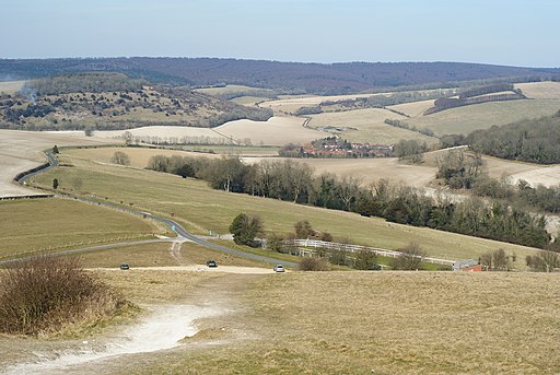
View Towards Charlton. The village of Charlton sits in a valley; bounded by the A285 to the east, and the A286 to the west.
View up towards The Trundle from the bottom of the hill. The raised earthworks can be seen, towards the centre of picture. The hillfort is still a sizable earthwork, but it wasn't discovered as a Neolithic site until 1925, when archaeologist O.G.S. Crawford took an aerial shot that showed more buildings inside the hillfort's ramparts. Only five causewayed enclosures were known at the time; the photograph convinced archaeologist E. Cecil Curwen to investigate the site in 1928 and 1930. These early excavations revealed the presence of the Neolithic site and assigned a building date for the hillfort of between 500 BC and 100 BC.


