Wadebridge Walks - Camel Trail Wadebridge to Padstow Walk
![]()
![]() This market town is situated in a lovely spot on the River Camel in North Cornwall.
This market town is situated in a lovely spot on the River Camel in North Cornwall.
This walk from the town follows the popular Camel Trail along the estuary to nearby Padstow. The walk runs for just over 5 miles, following a fairly flat waymarked trail for the whole way.
The route starts in Wadebridge and follows the trail north west, passing Tregunna, Pinkson Creek, Lower Halwyn, Ball Hill, Dennis Hill and Tregonce before coming into Padstow. There's lovely views to the Camel Estuary where you can look out for a variety of birdlife including herons and little egrets.
If you head south along the trail it will take you towards Bodmin, passing Grogley Woods on the way. The woods are a good local spot for walks and mountain biking with several challenging black trails to try.
Wadebridge Ordnance Survey Map  - view and print off detailed OS map
Wadebridge Open Street Map  - view and print off detailed map
Wadebridge OS Map  - Mobile GPS OS Map with Location tracking
Wadebridge Open Street Map  - Mobile GPS Map with Location tracking
Pubs/Cafes
The Old Tea House is a quaint little place for refreshments in Wadebridge. They do a delicious cream tea and have some fine home made cakes as well. You can find them at 6 Polmorla Rd with a postcode of PL27 7ND for your sat navs. For a pub lunch head to the noteworthy Maltsters Arms. The 16th century pub is located in a lovely spot on the village green.
Dog Walking
The trail is a nice one to do with your dog though there are plenty of cyclists around. The Old Tea House and The Maltsters Arms mentioned above are also dog friendly.
Further Information and Other Local Ideas
Wadebridge also lies on the Saints Way. This long distance trail takes you across the county from Padstow in the north to Fowey on the south coast. It follows the probable route of early Christian travellers making their way from Ireland to the Continent.
In Padstow you can pick up the Padstow to Trevone Bay Walk, the Padstow to Harlyn Bay Walk and head up to the popular headland at Stepper Point. There's also the option of catching the ferry over to Rock and heading north on the Rock to Polzeath Walk.
For more walking ideas in the area see the Cornwall Walks page.
Cycle Routes and Walking Routes Nearby
Photos
View from Anneka's Bridge over the River Camel at Wadebridge, Cornwall, showing the 15th-century Old Bridge and 20th-century A39 road bridge
The Camel Trail crossing Pinkson Creek. The cycle trail, which was originally a railway line, crosses the mouth of the creek by means of an embankment with just one bridged section to let the water run in and out of the creek to the right of the photograph.
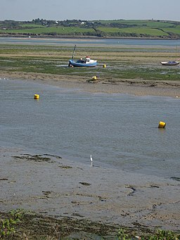
Camel estuary and mudflats with view to Dinham. Further down the Camel there are extensive sand banks, on this stretch there is mud - much favoured by birds. As well as five swans making a stately procession down the river I could see a heron, an egret, seagulls and waders.


