Wareham Walks
![]()
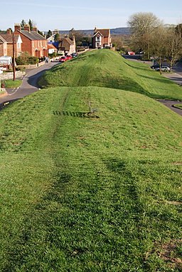
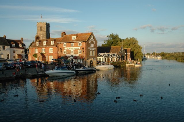
![]() The pretty Dorset town of Wareham has some lovely waterside walks along the rivers which pass through the area. There's also the interesting walk along the historic town walls and a number of long distance trails running through the town.
The pretty Dorset town of Wareham has some lovely waterside walks along the rivers which pass through the area. There's also the interesting walk along the historic town walls and a number of long distance trails running through the town.
This circular walk takes you around the town visiting the River Piddle, Wareham Common, the town walls and the River Frome.
The walk starts near the North Bridge and heads west along the Piddle towards Wareham Common. You then pick up a section of the Purbeck Way to take you to the west walls and south bridge where there are nice views of the River Frome. There's some good pubs and cafes with outdoor seating here.
The walk then takes you along the east walls before returning to North Bridge where you pass the noteworthy St Martin's Church. The Anglo-Saxon church is a Grade I listed building and a Scheduled Ancient Monument, dating from 1030. On the north wall of the chancel are 12th-century frescoes depicting Saint Martin on horseback.
The long distance Purbeck Way passes through the town and is a great way of extending your walking in the area. Following it south will take you to Stoborough Heath and the village of Corfe Castle where you will find the fascinating ruins of the 11th century ruined castle.
The Wareham Forest Way also passes through the area.
Head north and you can explore the River Piddle Valley before passing through the conifer plantations of the forest where you can look out for an abundance of wildlife.
Wareham Ordnance Survey Map  - view and print off detailed OS map
Wareham Open Street Map  - view and print off detailed map
Wareham OS Map  - Mobile GPS OS Map with Location tracking
Wareham Open Street Map  - Mobile GPS Map with Location tracking
Walks near Wareham
- Sika Trail - This signed off road circular trail takes you on a tour of the peaceful Wareham Forest in Dorset.
You will pass through the high forest and open heath of the area with its variety of wildlife - Hartland Moor - This walk visits the splendid Hartland Moor National Nature Reserve near Wareham in Dorset
- Purbeck Way - This beautiful walk takes you from Wareham to Swanage giving splendid views of the Purbeck Hills and the Dorset coast
- Wareham Forest Way - This walk follows the Wareham Forest Way from Wareham to Sturminster Marshall
- Arne Nature Reserve - This beautiful coastal nature reserve is located near Wareham in Dorset
- Blue Pool Dorset - This extraordinary lake in Dorset is located near Wareham and Corfe Castle
- The Hardy Way - Wareham-Corfe Castle-Kimmeridge - The Hardy Way is a long distance walk created to celebrate the life and works of the author Thomas Hardy
- Bere Regis - This circular walk from the Dorset village of Bere Regis visits Bryants Puddle Heath, Bovington Heath and Lawrence of Arabia's cottage near Moreton.
- Corfe Castle - This circular walk takes you around the Dorset village of Corfe Castle, visiting Corfe Common and passing the fascinating ruins of the 11th century ruined castle
- Winfrith Newburgh - This village in Dorset is located near Wareham and the county town of Dorchester
- Sandford - This Dorset based village is located just to the north east of Wareham.
Further Information and Other Local Ideas
Just to the north east you can pick up the circular Bere Regis Walk and visit Moreton, Bovington Heath and the noteworthy Clouds Hill, the former home of Lawrence of Arabia. Near here there's the Winfrith Newburgh Heath and Tadnoll Nature Reserves. The reserves include miles of peaceful heathland trails with lots of wildlife and a splendid viewpoint.
Also north east is neighbouring Sandford where you can enjoy some fine trails around the Holton Heath Nature Reserve.
For more walking ideas in the area see the Dorset Walks page.


