Weddington Country Walk
![]()
![]() This route takes you along the Weddington Country Walk near Nuneaton in Warwickshire.
This route takes you along the Weddington Country Walk near Nuneaton in Warwickshire.
The shared cycling and walking trail runs along the trackbed of the old Ashby and Nuneaton Railway for a distance of about 1.5 miles.
Start the walk to the south of Weddington at Sandon Park. The pleasant surfaced trail then heads north east towards Hungry Hill, just south of Higham on the Hill.
The path makes up a section of Sustrans National Cycle Route 52 which can be used to further explore the area. If you were to head south you could pick up the Coventry Canal and enjoy some easy waterside walking or cycling.
Weddington Country Walk Ordnance Survey Map  - view and print off detailed OS map
Weddington Country Walk Open Street Map  - view and print off detailed map
Weddington Country Walk OS Map  - Mobile GPS OS Map with Location tracking
Weddington Country Walk Open Street Map  - Mobile GPS Map with Location tracking
Pubs/Cafes
Head into Weddington and you could enjoy some refreshments at the Anker Inn. The pub serves food and has a garden area to sit out in. You can find them at postcode CV10 0AN for your sat navs. They are dog friendly.
Cycle Routes and Walking Routes Nearby
Photos
Climb to the Walk. This short climb up an old railway embankment is part of Weddington Country Walk.
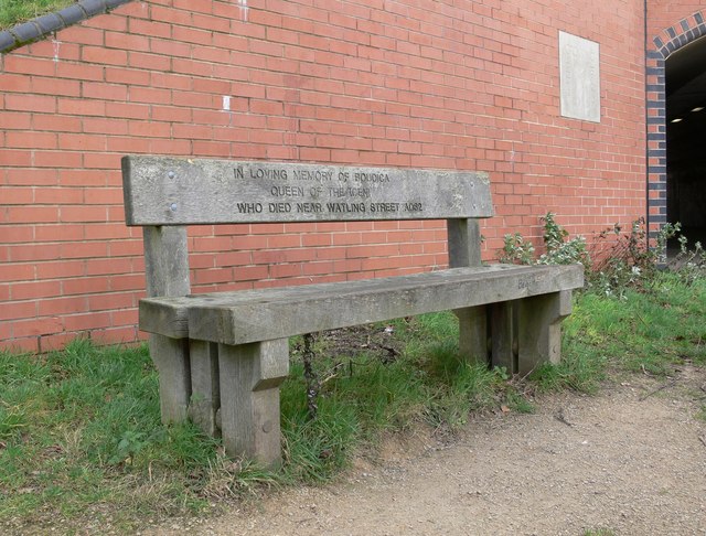
In Loving Memory of Boudica This seat is located along the Weddington Country Walk next to the underpass which carries the Country Walk and National Cycle Network 52 under the A5 Watling Street. The seat is inscribed with: 'IN LOVING MEMORY OF BOUDICA, QUEEN OF THE ICENI, WHO DIED NEAR WATLING STREET AD62'
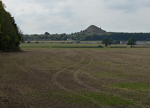
View towards Mount Judd, a man made hill and landmark you can see from the trail. The hill is the former spoil tip of the Judkins Quarry, which extracted granite in the area. Mount Judd is a famous local landmark and in 2018 was voted the United Kingdom's "best landmark" in a Daily Mirror poll. At 158 metres (518 feet) altitude it is the 3,306th highest hill in England.


