Weston-Super-Mare Walks - Near and Around
![]()
![]() This Somerset seaside resort has some fine coastal walking, a large area of local woodland, some fine hill climbs and a nature reserve with lots of coastal wildlife to see.
This Somerset seaside resort has some fine coastal walking, a large area of local woodland, some fine hill climbs and a nature reserve with lots of coastal wildlife to see.
This walk from the town visits two of the walking highlights of the area at Sand Point and Weston Woods. There's also some history with a visit to an ancient priory located near to the town.
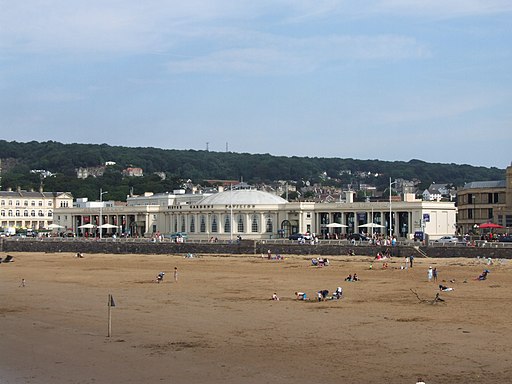
The walk starts at the Grand Pier on the sea front and follows the coastal path north past the Marine Lake and Birnbeck Island. You continue north along Sand Bay, passing the village of Kewstoke before arriving at Sand Point and Middle Point. The beautiful peninsula is a fine place for a walk with lots of wildlife and fine views over the Bristol Channel to Wales. The route also takes you east through the reserve to visit the 13th century Woodspring Priory.
After exploring the reserve and the priory you head south to follow footpaths through the countryside on the northern side of the town. These will lead you back to Kewstoke where you enter Weston Woods. There's some peaceful woodland trails here, taking you to Worlebury Hill before returning to the coast path. You can then follow this back into Weston-Super-Mare.
Postcode
BS23 1AL - Please note: Postcode may be approximate for some rural locationsWeston-Super-Mare Ordnance Survey Map  - view and print off detailed OS map
Weston-Super-Mare Open Street Map  - view and print off detailed map
Weston-Super-Mare OS Map  - Mobile GPS OS Map with Location tracking
Weston-Super-Mare Open Street Map  - Mobile GPS Map with Location tracking
Pubs/Cafes
Captains Cabin Bar & Restaurant is a great choice for some refreshments on the walk. It's in a fine location, right on the coast near the old Birnbeck Pier. There's a lovely terrace area where you can enjoy a drink with sea views. They also do a fine Sunday roast if you are feeling peckish. You can find them on 51 Birnbeck Road with a postcode of BS23 2EF for your sat navs.
Dog Walking
The beaches, coastal paths and woodland make for a fine dog walk. The Captains Cabin Bar & Restaurant mentioned above is also dog friendly.
Further Information and Other Local Ideas
Just to south of the town you'll find another major local highlight at Brean Down. You can follow a nice coastal path from here to visit Burnham on Sea.
A few miles south east of the town there's another fine viewpoint to be found on Bleadon Hill.
Just to the south is the delightful Uphill Nature Reserve. The reserve is well worth exploring with great views from the high point at Uphill Beacon and lots of interesting flora and fauna. The reserve is located in the neighbouring village of Uphill which also includes an elevated church and the remains of the old windmill.
For more walking ideas in the area see the Somerset Walks and Mendip Hills Walks pages.
Cycle Routes and Walking Routes Nearby
Photos
Birnbeck Island and pier. It is notable as the only pier in the country which links the mainland to an island. The Grade II listed pier dates from 1867 and is located just north of the town. The pier has been closed to the public since 1994 and is now on the Buildings at Risk Register. Sadly it remains in a largely derelict state.
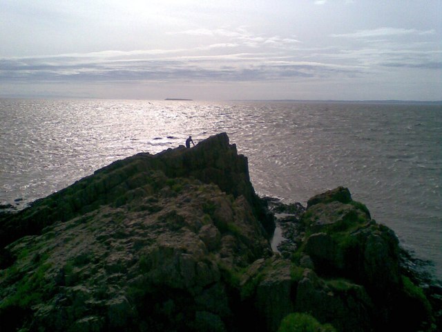
Ridge near Sand Point. This small peninsula at the northern end of Sand Bay is owned by the National Trust. On a summer's day such as this it is idyllic with a mass of wild flowers - wild thyme, saxifrages, thrift, etc - and insects, with views all around - across the Bristol Channel, across Sand Bay towards Weston-Super-Mare. This view looks east along the ridge.


