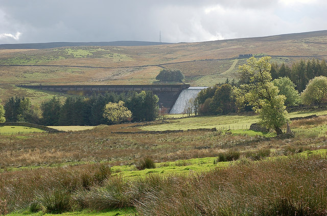
Wet Sleddale Reservoir
![]()
![]() This circular walk takes you around Wet Sleddale Reservoir near Penrith in Cumbria.
This circular walk takes you around Wet Sleddale Reservoir near Penrith in Cumbria.
You can start the walk from the car park at the eastern end of the reservoir, next to the dam. Then pick up footpaths heading west to Sleddale Hall. Film buffs may recognise this as the location of Crow Crag from the 1987 fillm 'Withnail and I' starring Richard E Grant.
You then follow trails east to Bowfield and Thorney Bank before crossing the River Lowther. Quiet country lanes will then take you west back to the car park.
Postcode
CA10 3NE - Please note: Postcode may be approximate for some rural locationsWet Sleddale Reservoir Ordnance Survey Map  - view and print off detailed OS map
Wet Sleddale Reservoir Open Street Map  - view and print off detailed map
Wet Sleddale Reservoir OS Map  - Mobile GPS OS Map with Location tracking
Wet Sleddale Reservoir Open Street Map  - Mobile GPS Map with Location tracking
Further Information and Other Local Ideas
Just to the north you can extend your walking around the 13th century Shap Abbey.
To the north east is Crosby Ravensworth where you can visit the 18th century pub and the ancient church which sits in a picturesque location next to the Dalebanks Beck. You can also pick up our circular walk which visits Oddendale and Crosby Ravensworth Fell where there are great views and a photogenic expanse of limestone pavement at the nearby Orton Scar.
Cycle Routes and Walking Routes Nearby
Photos
Sleddale Hall. Now famous as the film location "Crow Crag" in the 1986 film "Withnail and I". The "cottage" in the film is owned by Uncle Monty; from whom Withnail borrows the key. The two out of work actors come to a wet "Crow Crag" on holiday by mistake with no food or other provisions.


