Wheddon Cross Walks
![]()
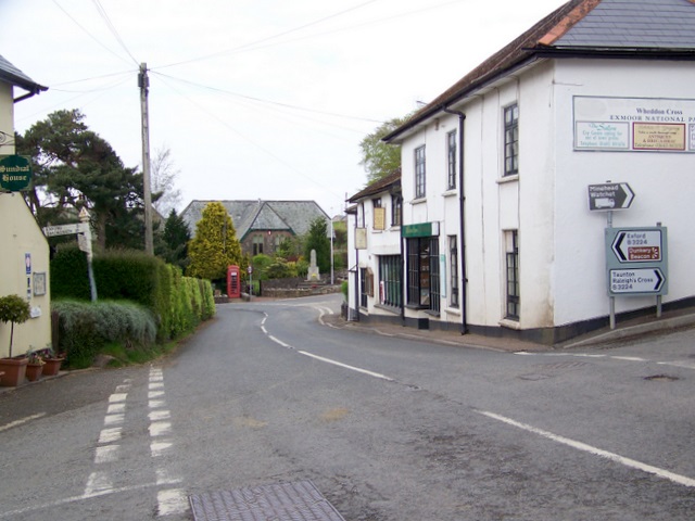
![]() Wheddon Cross is a Somerset based settlement notable as the highest village in the Exmoor National Park.
Wheddon Cross is a Somerset based settlement notable as the highest village in the Exmoor National Park.
As such it's a fine place to start a walk with miles of footpaths heading into the hills and surrounding countryside. There's also the Snowdrop Valley walks in February when the privately owned estate is opened to the public. Click here for more information on this popular winter walk.
This circular walk takes you along the public footpaths that run past part of the Snowdrop valley to the north east of the settlement. Along the way there's some pleasant woodland trails and views of the River Avill which runs through the area.
You'll then climb to Dunkery Beacon where there are some splendid views over Exmoor.
Also of interest is the climb to Lype Hill in the Brendon Hills which can be accessed just to the south east of the village. This is a good choice for continuing your walking in the area.
Postcode
TA24 7DR - Please note: Postcode may be approximate for some rural locationsWheddon Cross Ordnance Survey Map  - view and print off detailed OS map
Wheddon Cross Open Street Map  - view and print off detailed map
Wheddon Cross OS Map  - Mobile GPS OS Map with Location tracking
Wheddon Cross Open Street Map  - Mobile GPS Map with Location tracking
Walks near Wheddon Cross
- Brendon Hills - Explore the Brendon Hills range on this challenging walk in the Exmoor National Park
- Combe Sydenham Country Park - This country park consists of 500 acres of woodland, parkland and gardens surrounding a Grade I listed 15th century manor house
- Coleridge Way - Travel through the Exmoor National Park and the stunning Quantocks Hills as you walk in the footsteps of poet Samuel Taylor Coleridge.
You start off in the pretty village of Nether Stowey, at the foot of the Quantock Hills and head west towards Holford, passing the iron age fort of Dowsborough on the way.
You continue through a wooded section at Alfroxton Woods and onto Stowborrow Hill with its resident deer before passing through Bicknoller and Monksilver where you enter Combe Sydenham Country Park - Dunkery Beacon - This walk climbs to Dunkery Beacon on Dunkery Hill, the highest point in Exmoor and Somerset
- Samaritans Way South West - Starting at Bristol follow the Samaritans Way to Lynton, in Devon, and visit the Avon Gorge, the Chew Valley, the Cheddar Gorge, the Mendips, the Quantock Hills and the Brendon Hills
- Clatworthy Reservoir - Enjoy a walk around this pretty reservoir in the Brendon Hills on the edge of the Exmoor National Park
- Wimbleball Lake - Enjoy cycling and walking trails around this large lake on Exmoor
- Haddon Hill - This circular walk explores Haddon Hill in the Brompton Regis area of Somerset
- Nutscale Reservoir - This small reservoir is located on Exmoor near Minehead
- Wiveliscombe - This historic market town is located near Taunton in the county of Somerset
Pubs/Cafes
The Rest and Be Thankful Inn is a fine village pub for some post walk refreshments. The 19th century coaching inn has an interesting history having originally been a staging post for travellers on their way between Dunster and Dulverton about 200 years ago. The bar area has a traditional country pub atmosphere, with log fires in winter and a good menu. There is a skittle alley and a pool table here too. You can find the inn at a postcode of TA24 7DR for your sat navs. The pub is nicely positioned in the Snowdrop Valley with tours and walks to the valley accessible from the bus leaving right from the door. They are dog friendly and also provide good quality accommodation if you need to stay over.


